
More Potential Areas to Watch
Now that Dorian has exited the Carolina coast, we have some quieter times ahead in the tropics where we can recover from what this hurricane has brought to our two states.
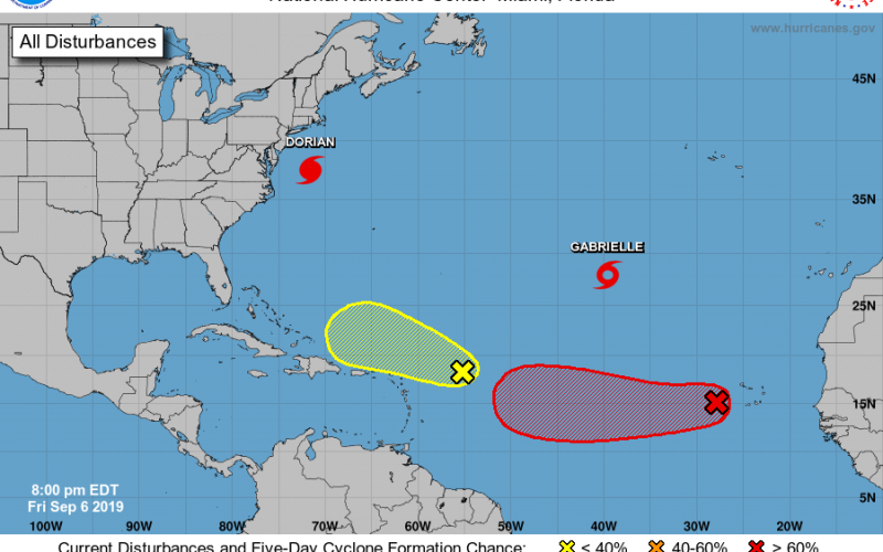
However, we are still in hurricane season. In fact we are just now approaching the climatological peak of hurricane season which is September 10th. Hurricane season runs through November 30th. Dorian became rather significant unexpectedly, and around that time-frame there really wasn’t a lot of noteworthy activity in the Atlantic. For days it’s kept our focus, with little attention given to anything else. Well, if you haven’t noticed, during our time tracking Dorian the rest of the tropics have also decided to wake up, and it’s no longer exactly crickets in the world of the Atlantic. Take a look:
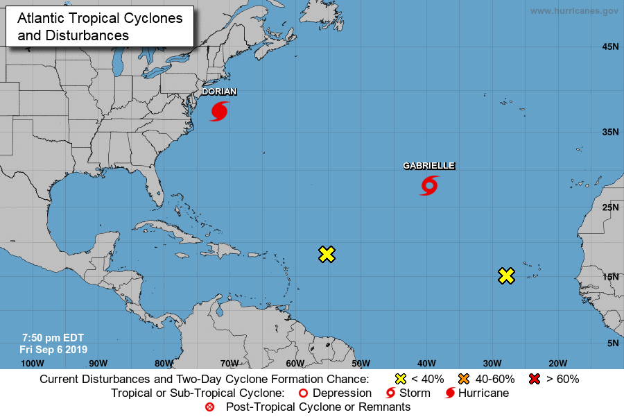
Gabrielle is currently at tropical storm strength, but remains of no threat to US soil whatsoever, and remains thousands of miles away from the East Coast. Her future progression will be a track northeastward, taking her even farther away from the East Coast.
Two more tropical items of interest, and their probabilities of development are detailed in the latest 5-day tropical outlook from The National Hurricane Center:
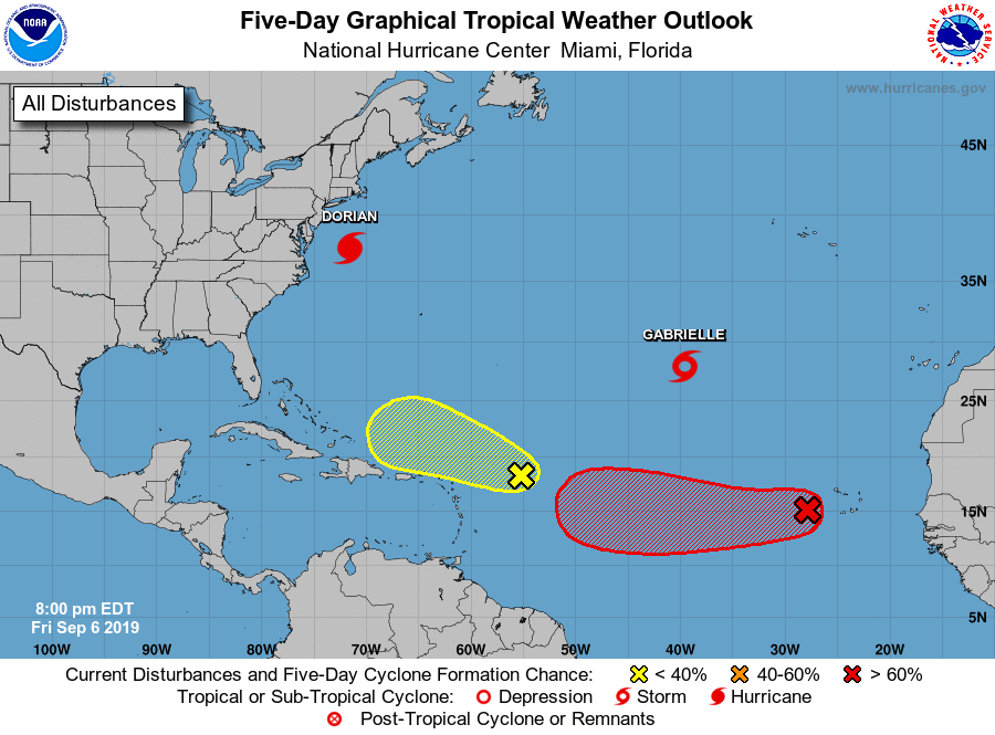
Currently, there’s also a rather anemic wave of showers in the Atlantic a few hundred miles northeast of the Leeward Islands, but this warrants little to no attention as probability of development remains no more than 10% over the next 5 days. The main item of interest is actually the one behind this one much further to the east.
Cabo Verde Threat
The Cabo Verde Islands just west of the African Coast are often referred to as the main development region of the Atlantic. What is rather concerning is that this latest outlook from the National Hurricane Center has a 70% probability out for tropical formation of a wave in that region over the next 5 days as it travels westward across the Atlantic.
This tropical cyclone of undetermined strength may or may not make it’s way to the US coast sometime later this month. There’s a little bit of subtle hinting from some of the modeling, but nothing we can really pin down and latch onto at this time. It’s too early to determine the exact evolution of this tropical disturbance and where exactly it will go, but we will keep you informed of the latest on this in the days ahead, as well as any other tropical activity of significance in the Atlantic basin. Stay tuned on the Facebook and Twitter pages, as well as on our site for the latest developments.
-Jesse
Carolina Weather Authority
You must be logged in to post a comment.