
We already had our first hurricane of 2020, which was Hanna in south Texas. Gonzalo has died out in the Caribbean. But now, all eyes shift to Invest 92L in the Atlantic, which will likely become Isaias this week (this name is cumbersome to spell, and equally as tricky pronouncing). This disturbance which could become a tropical storm or hurricane over the coming week has a lot of buzz on social media.
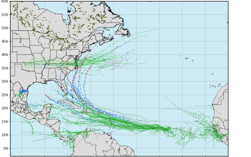
But how certain are the tracks of future Isaias. Well, there is quite a spread. The Euro below has tracks anywhere from the Gulf of Mexico to the Southeast Coast to out to sea. There still is a wide range of uncertainty.
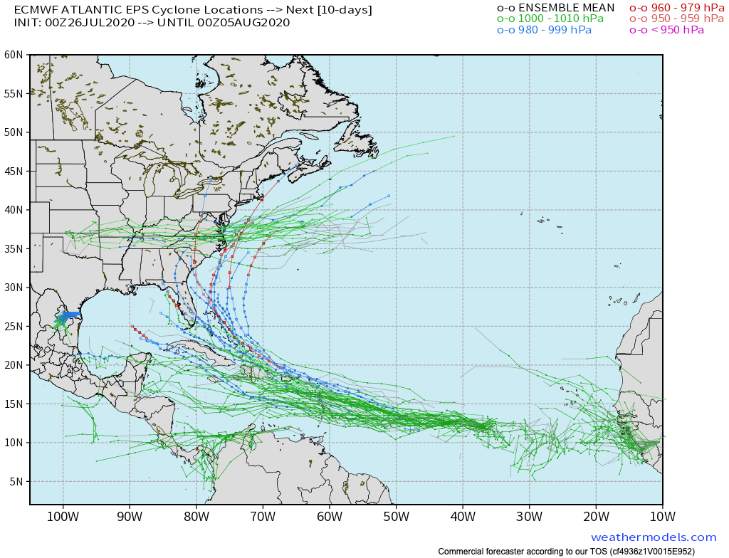
The GEFS tracks are in a bit better agreement, although still not tight agreement. Still, a few tracks do hit the southeast U.S. What this means is that we have to watch this system closely here in the Carolinas. The storm has not formed yet and we will not have more track confidence until it does.

This is big weather news currently and we will continue to bring you the latest with Invest 92L. For now, enjoy the beach and vacations because this system is still at least a week away.
-Mike G.
You must be logged in to post a comment.