How to Interpret Weather Radar, What do the Images Mean
When we look at a radar image, the first thing we notice is all the colors. Sometimes there is nothing but a blank screen. Sometimes there is just a little bit of green. All these colors on radar images, sometimes none, but what does it all mean? Are you curious how to read weather radar and don’t know what you’re looking at when someone posts a radar image?
Well you’ve come to the right place, since I will teach you a lot about weather radar, maybe not everything, but as much as I can so that you can develop a basic understanding. After this lesson, you will be able to look at a radar screen and be able to tell what is going on with the weather.
First of all, let’s talk about how radar works. RADAR is an acronym, and it stands for RAdio Distance And Ranging. What this means is that an antenna can detect how far an object is from the antenna by using a series of complex algorithms. When the radar antenna sends out a pulse, the time it takes for the pulse to return to the antenna is how the radar can determine how far an object is away. The object of interest, in this case, is either rain drops or ice crystals.
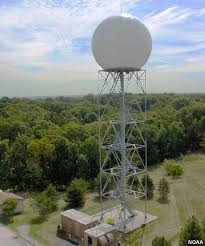
A typical weather radar antenna is Doppler Radar, and this is widely used by the National Weather Service. The current model in service is called the WSR-88D. WSR stands for Weather Service Radar, 88 is the year the radar came out, 1988, and the D stands for Doppler. There is one of these radar facilities at each National Weather Service office in the US. This network of radars is then disseminated to the public for our viewing and interpretation of the data.
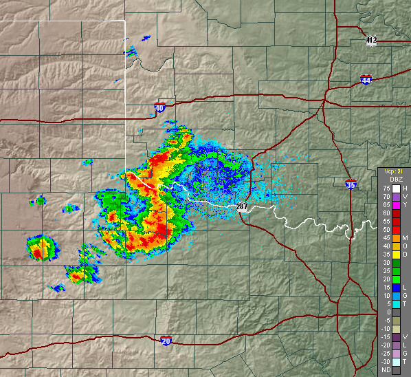
What about the actual images and what is happening in them? Here is a radar image from Texas, and we can see the radar echoes being displayed. The intensity of the echo is seen on the color legend on the right. Therefore, we can safely assume that these echoes are thunderstorms. This is because thunderstorms usually have very heavy rain. More coming on this topic! Stay tuned!