
This weekend’s storm is looking a bit more like rain for much of the NC piedmont, and for SC also. The places more likely to get snow are in the foothills and mountains of NC. A light wintry mix could start above I-40 and this mix could extend down into the SC Upstate. Northern GA could also be in for a mix and snow.
Below is the graphic and legend for what we are expecting:
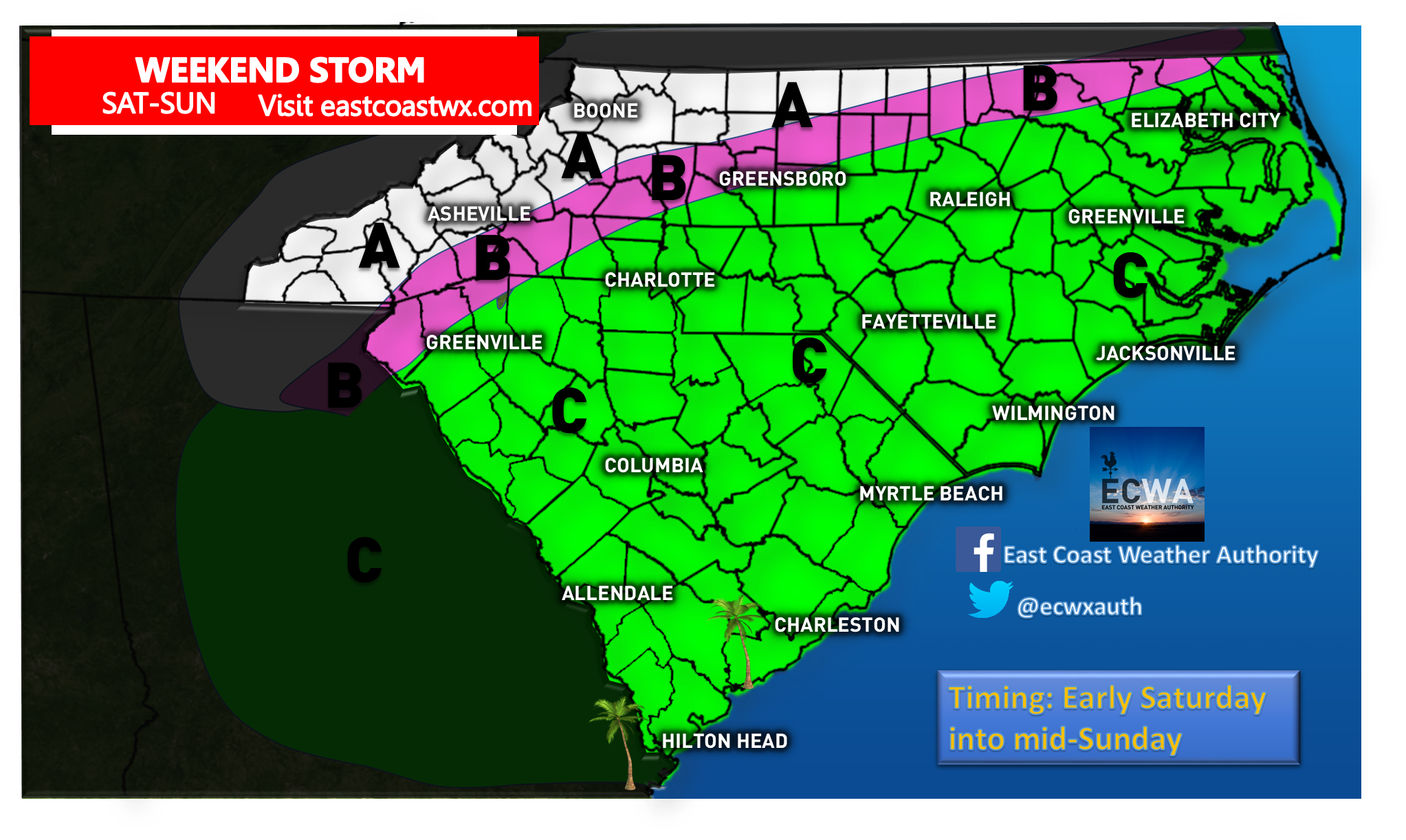
AREA A – Mainly snow for the event, could mix with sleet at times
AREA B – Wintry mix is possible or ice that could leave a glaze and dangerous driving conditions.
AREA C – This area will likely experience all rain.
The latest Canadian model may have a better handle on the warm air compared to other models.

You must be logged in to post a comment.