
This weekend could see some wintry weather across northern and western tiers of North Carolina. The precip could start as early as Saturday morning, and last until Sunday morning or even mid-day. See the below map and legend for what you can expect in your neighborhood:

AREA A – Highest confidence for snow, and some locations could top 6″, some locations higher depending on elevation. In the more southern A zones, sleet could mix in for longer.
AREA B – Wintry mix and rain, could alternate back and forth and may end as rain. Otherwise this could be a sleet belt with just a few flakes. This zone may change and is critical for any accumulations.
AREA C – This location will see mainly all rain from this event, as it will be too warm to snow.
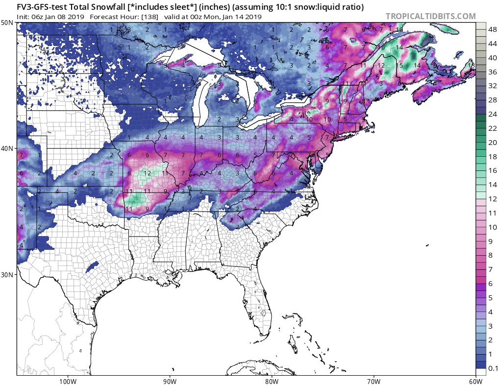
The FV3-GFS is indicating frozen precip for much of the western regions. Keep in mind these totals include sleet and ice for now, especially along the edges.
Stay tuned to our site here and also our FB page as this system evolves this week!
You must be logged in to post a comment.