
We are looking at our first major heatwave of the season next week, and it will be oppressive. I’m expecting some locations to reach the upper 90s including Richmond, Raleigh, and even Charlotte.
Monday the heat will make its presence known. We are looking at highs in the low to mid 90s for the Charlotte area, low 90s in the Triad, and upper 80s to near 90 in Raleigh. However, as the week progresses, we will begin to see these values rise even in the upstate SC. Tuesday high temperatures are a bit overdone in my opinion but the message is hot:
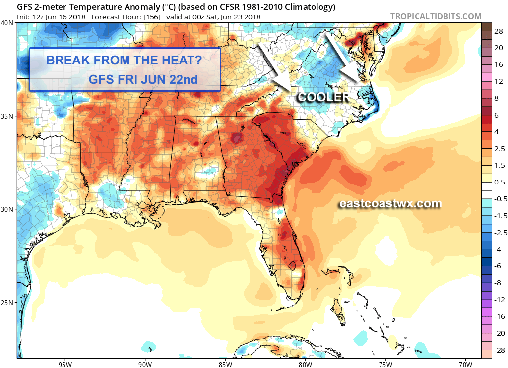
However, on Friday we could see a bit of a break from the extreme heat. Temperatures in Raleigh may not quite make it to 90. Charlotte might be the only location where temperatures may *touch* 90. Across SC, the heat remains. The cause for a slight break in the heat late next week could be a backdoor cold front which will cool things off. GFS highs for Friday:
There could be a weak wave of low pressure that forms along the front Thursday night. As a result, severe storms are possible. Any storm could put down hail or even a tornado. In addition, the storms would have a cooling effect on Thursday.
And then the relief comes. During the day Friday, departures from normal will be slightly below average. Still hot along the SC coast however. 2pm GFS temperature anomaly on the GFS:
A rainy pattern looks to set up after this cool-down. More showers and storms as well as humidity are likely through the 4th of July under southwest flow as high pressure will just be off the Southeast coast.