
As we head into Christmas, many maps are showing red for the temperatures across much of the country. That seems to be the only color on social media weather maps from now at least through the 28th.
Christmas will be warm this year, and unusually so. This is at least the second or third year in a row for many. But Jesse has alluded to a pattern shift in one of his previous posts.
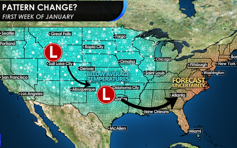
There could be a weakening in the ridge of high pressure that will have control over much of the eastern half of the country. After the 28th, we could get into a more traditional pattern, with around average temperatures.
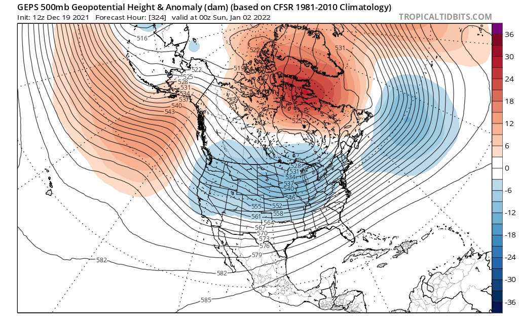
Right around the 2nd of January, the Canadian, or CMC model, has a flattening out of the “heat dome” and brings what could be a more traditional winter storm track
The only question will be, will this systems cut to our west and keep us on the mild side? Or will a few get to the Southeast, and become a Southern Slider? It might not be too cold, but an active southern jet stream coupled with the model image above could bring some white stuff to the mountains.
And if we’re lucky, other locations too 🙂
-Mike
You must be logged in to post a comment.