
As many have been watching the latest model trends on social media, some have gotten excited for a big snow across NC and VA. However, this is not the ideal setup for a big thumping of snow across the Piedmont. This storm system will start out as mainly rain, and then if we’re lucky enough cold air will move in late on Friday as the storm exits and change the precip over to rain.
However, a warm nose would decimate any kind of snowfall totals. Below are the future radars and timing for our storm.
A cold rain will move in tonight starting around 2pm. No snow is expected since it will be too warm.

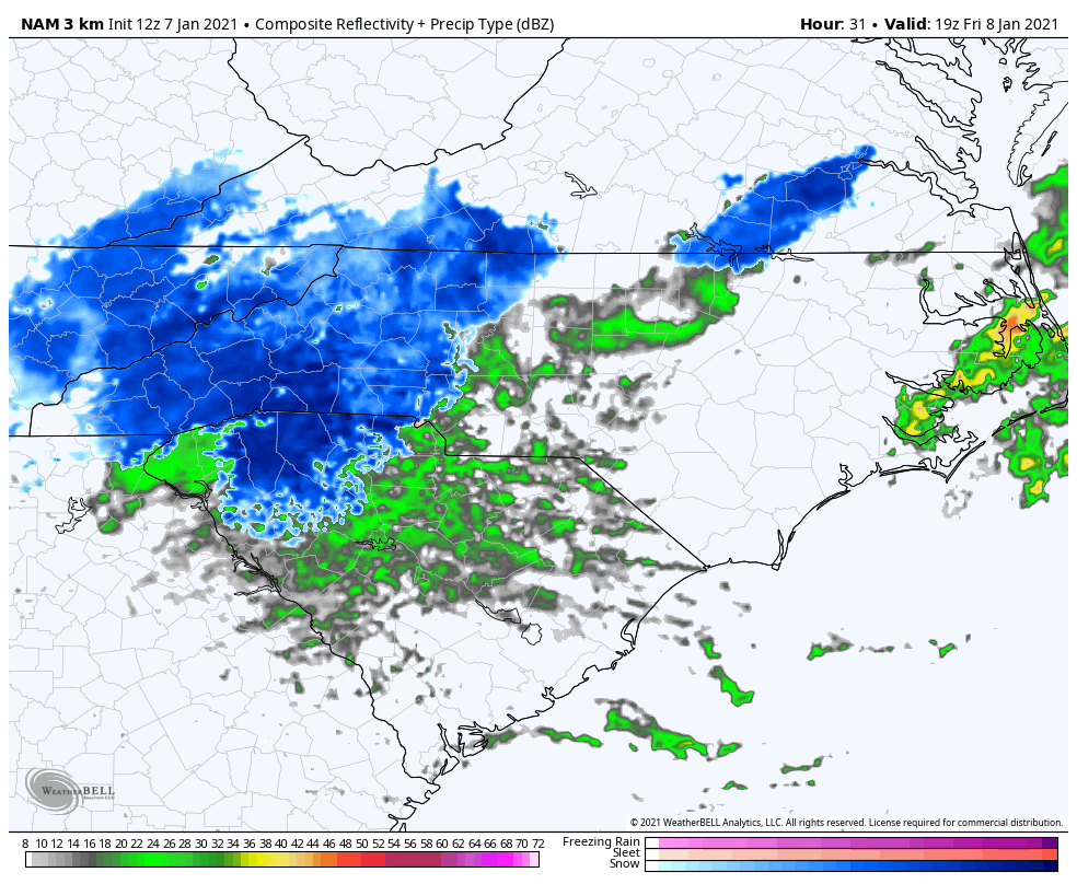
The next image below shows 2pm Friday afternoon. There will be a lot of mixing especially around Charlotte. However we think this will mainly be sleet with a cold rain. But a few flakes are possible anywhere in the blue. But don’t count on it especially if the rain persists and the warm nose wins out.
The next image below is for 7pm Friday. This will be everyone’s best chances for seeing flakes as this shield of possible snow moves east and follows the departing storm out to sea.

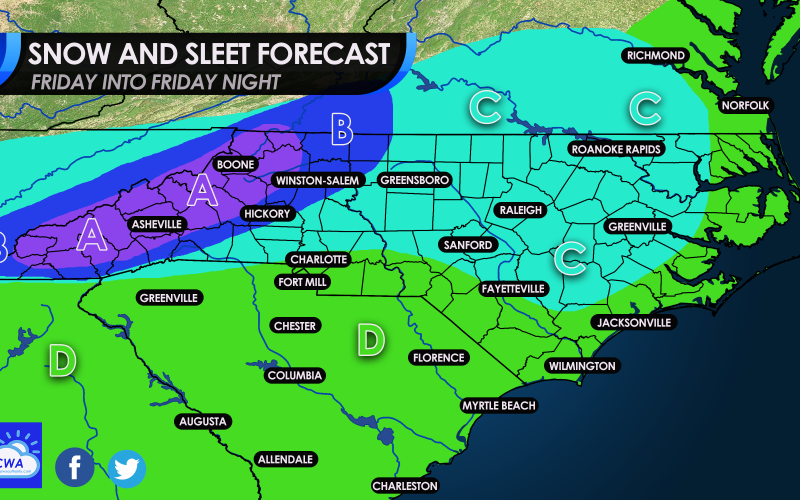
And now for the official call from Carolina Weather Authority for Friday 1/8, please see the legend below the map for details.
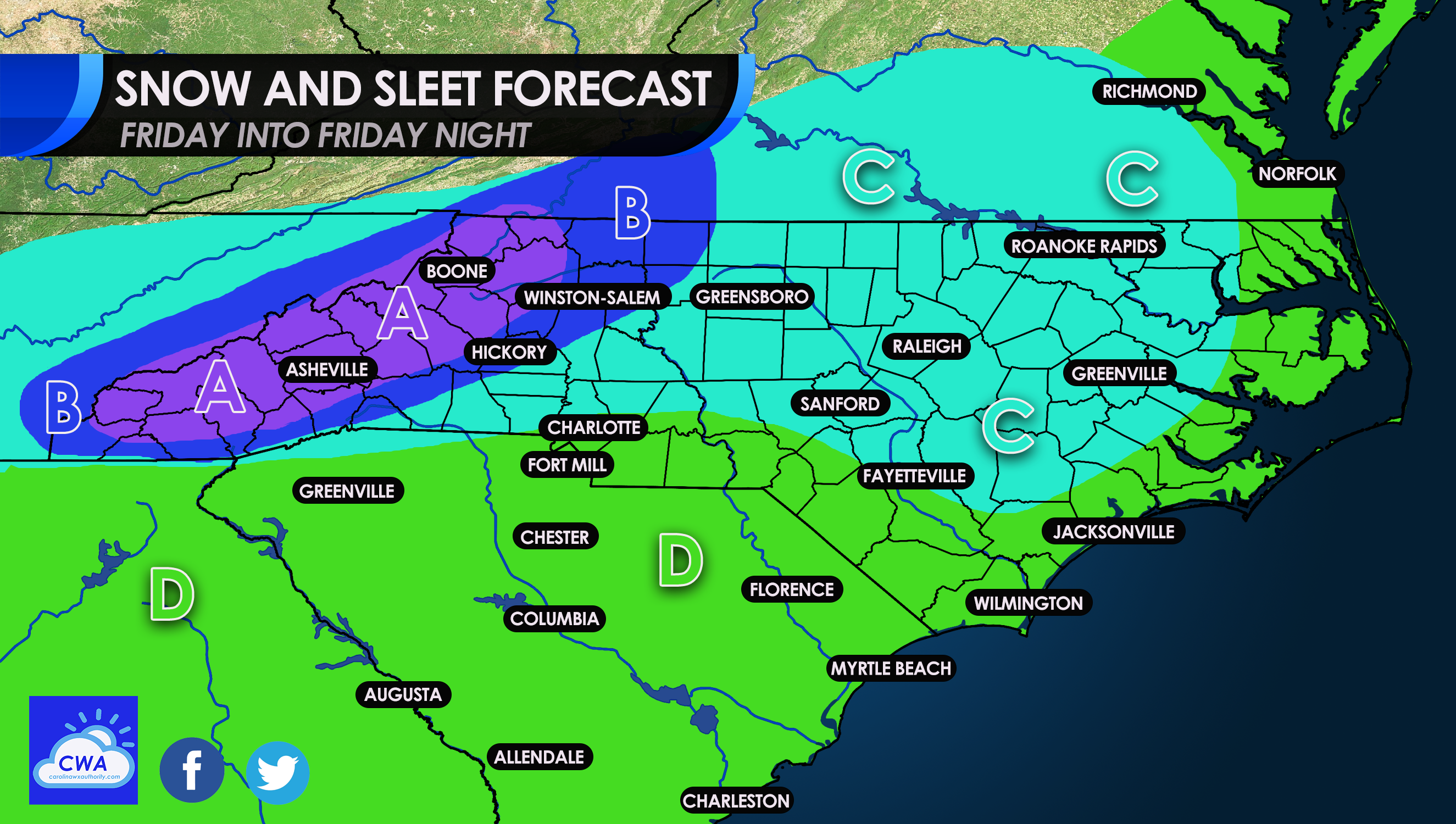
AREA A: This are in the mountains are in the best spot for accumulating snow. Locations in this area can see 6-10″ of snow.
AREA B: This is the second best area for snow. Expect accumulations of 4-8″
AREA C: This area will start as a cold rain and could mix with sleet later in the day. As colder air moves in, a changeover to snow is possible later in the day after mixing with sleet. Very light accumulations are expected, if any. No more than a spotty coating to an inch. It may be hard to get anything to stick other than just some flakes in the air.
AREA D: This area will most likely experience a cold rain. However, anywhere close to area C could see sleet mix in or even a few flakes.
This is a very complex storm and uncertainties are high. But this is our best guess for tomorrow’s winter storm. If you liked this article, please share with friends and family!
You must be logged in to post a comment.