
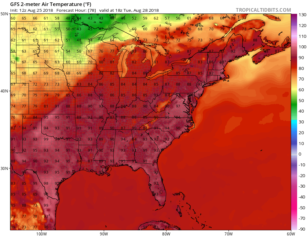
After a temporary reprieve from the heat and humidity, in some spots chilly, we will slowly begin to build the heat back once again. Some major East Coast cities will see heat indices in the triple digits due to the return of the humidity. As a ridge of high pressure takes shape over the East Coast, temperatures will climb back into the low to mid 90s. However, with the added humidity we will feel like we are in the 100s in spots. Triple-digit heat indices will be felt from the Mid-Atlantic to Florida starting on Tuesday next week. Wednesday will not feel much better outside unless that is your thing.
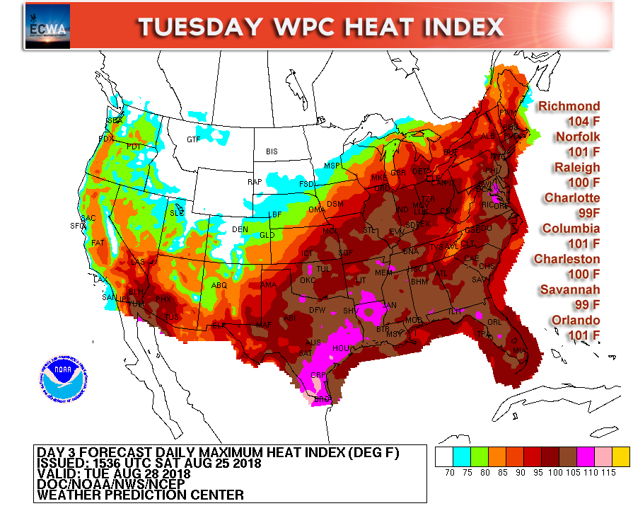
Highs will generally range from 90-95 F along the East Coast. We don’t think any locations will make it into the upper 90s given the time of year and the sun angle. Mid 90s is possible, and even that is rare for this time of year. We typically see more 85-90 F readings.
Take it easy if you are outside and stay hydrated. Water and sports drinks are good options. Don’t overdo it.
The heat will not last long into September, perhaps not longer than the first week. We are seeing major changes for the second half of September. Stay tuned and watch for our article!
Also if you would like DAILY forecast videos and discussions sent to your email, please follow the below link!
You must be logged in to post a comment.