
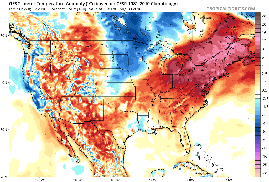
After our brief cool-down this week, summer will want to hang on one last time before letting go. However anything is still possible in September or October as far as heat, but not mid 90s heat. Later this month, a ridge of high pressure centered over North Carolina and Virginia will cause temperatures to soar once again. Temperatures will be above normal, but for this time of year above normal does not venture into the triple digits.
GFS temperature anomaly for August 29-30th:
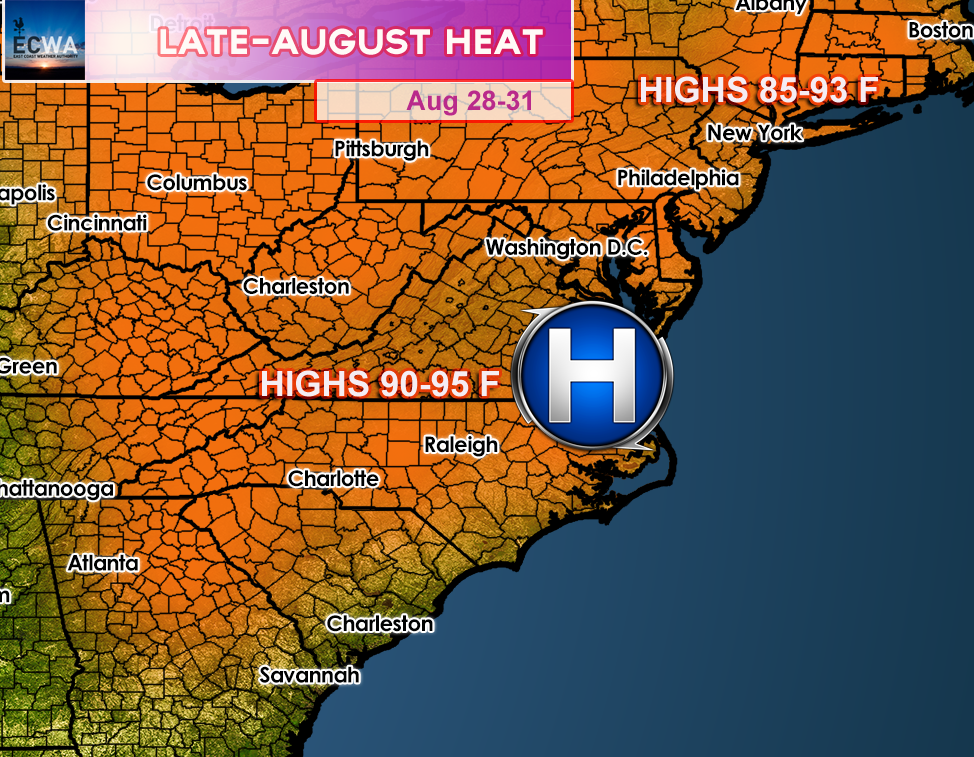
The heatwave is not expected to last long, as an upper level trough will move through our region to start September, and should suppress any excessive heat. To finish out August, highs will range from 90-95 F across the Southeast and in the upper 80s to low 90s across the Northeast. Drink plenty of water and take it easy if you are out in the heat a week from now! This also means that the rainy pattern we’ve had for much of the summer will subside, and flooded areas will get a break.
To get our DAILY forecast videos (M-F) and exclusive forecasts sent to your email, sign up for just 5.50 a month by following the link below!
You must be logged in to post a comment.