
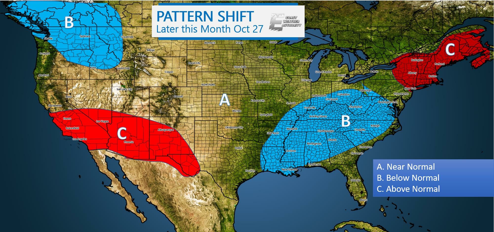
Observing a potential pattern shift around the 27th. There will be one next week on Tuesday or Wednesday, but then a pronounced one moves throughRead More
Observing a potential pattern shift around the 27th. There will be one next week on Tuesday or Wednesday, but then a pronounced one moves throughRead More
Yes it’s hot out there, but we will only be stuck in this pattern for another week or so. A strong cold front will pushRead More
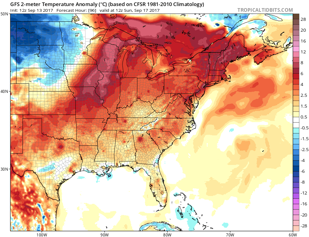
Meteorologist Mike Griffith SEPTEMBER TO END WARM, OCTOBER STARTS COOL It has been quite warm out there for the past week or so, maybe longer.Read More
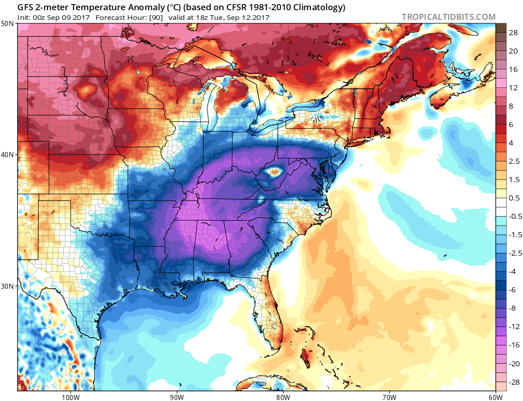
After a brief spell of cooler than usual temperatures, mainly across the South, we will warm up once again for many here in the East.Read More
Summer is coming to a close, and will transition to fall later this month. Meteorological Fall actually started on September 1st, and many of usRead More
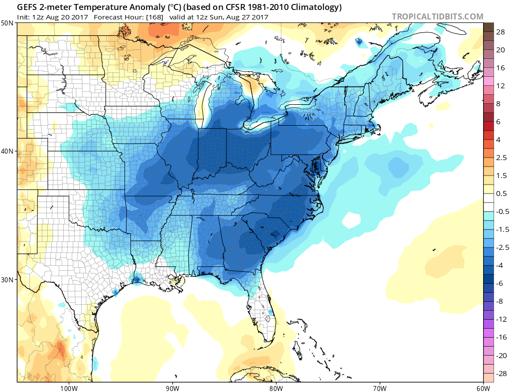
We are looking at below normal temperatures to start of September here in the East. At first, it will mainly be due to rain, howeverRead More
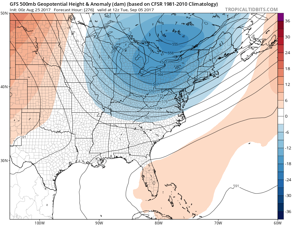
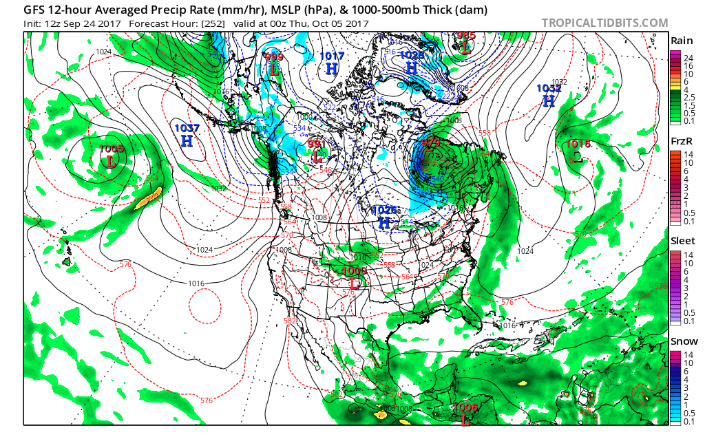
Looking into the first week of September, the GFS is showing another large-scale trough over the Eastern US and Mid-Atlantic around September 5th. This wouldRead More

HARVEY EXPECTED TO IMPACT TEXAS COAST, COLD FRONT PUSHING THROUGH EASTERN THIRD OF US Harvey is making headlines in the Gulf, as well as InvestRead More
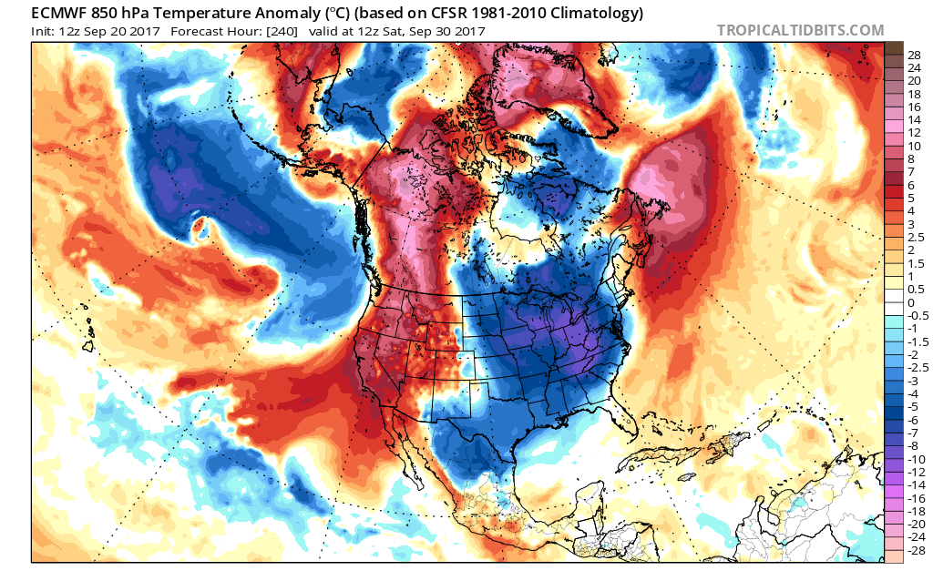
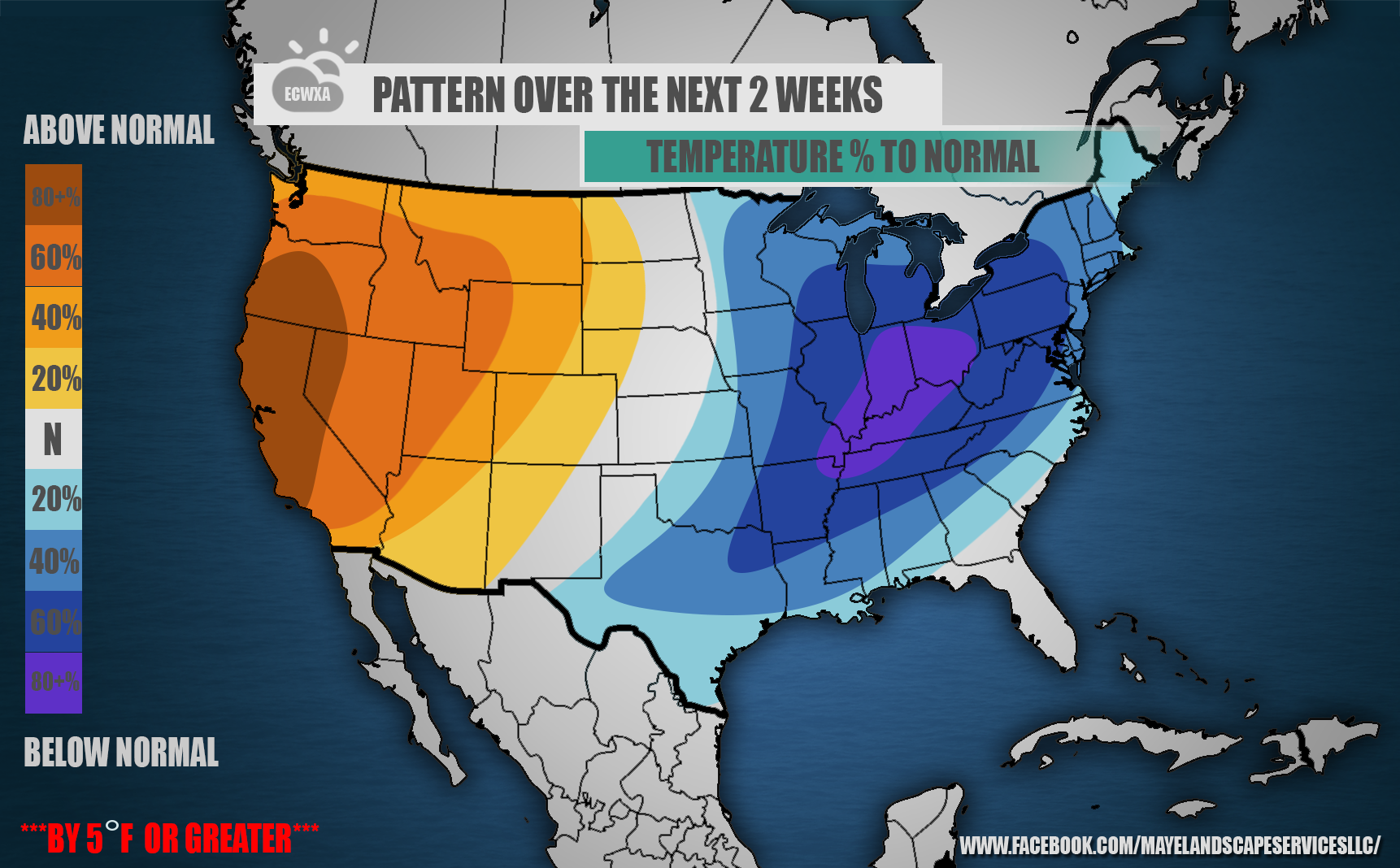
COOL DOWN COMING FOR MANY, MOST LIKELY TO BE FELT IN THE SOUTHEAST The GEFS ensembles are locking on to the idea of below normalRead More
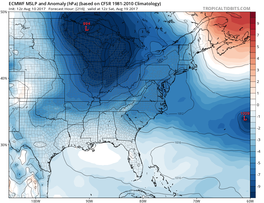
Sub-1000mb low is showing to move across the upper Great Lakes next weekend. This would mean a good shot for rain, and below normal temperatures.Read More
You must be logged in to post a comment.