
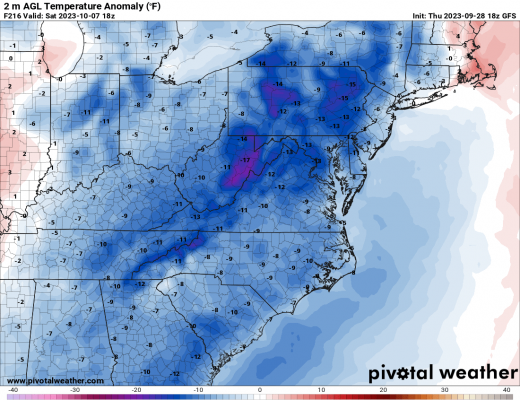
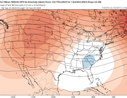
While the beginning of October is looking above average, there are now signs of a potential shift in the pattern to an trough in theRead More
While the beginning of October is looking above average, there are now signs of a potential shift in the pattern to an trough in theRead More
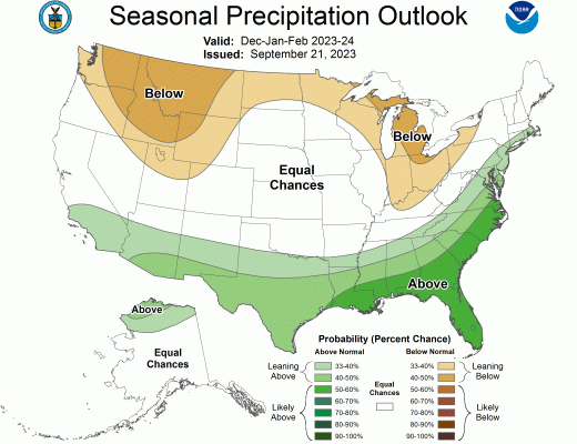
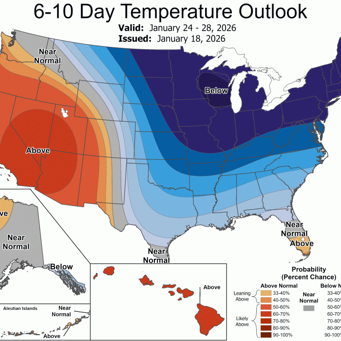
With the upcoming winter, many know that El Nino will play a role in what kind of winter we will have. According to NOAA’s latestRead More
The current NOAA Climate Outlook calls for a warm end to September and also dry. This pattern looks to hold into October, but then couldRead More
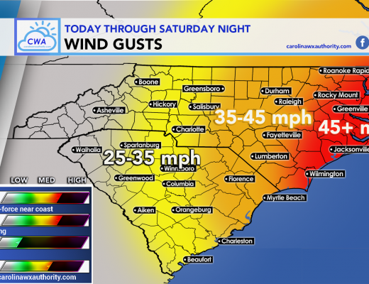
Be careful if you’re out driving today, tonight, or tomorrow, as gusty winds can take down tree branches and drop them in the road. Also,Read More
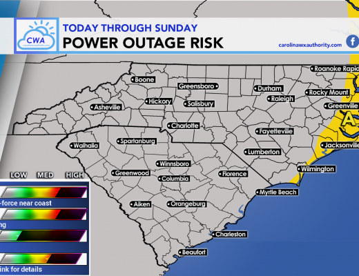
Power outages will be a concern near the coast and slightly inland. The map below shows were the most likely localized power outages will be,Read More
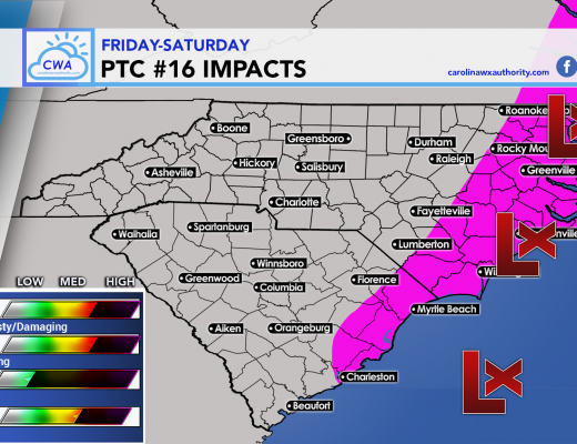
PTC 16 has formed and will continue to strengthen into Friday. This storm system could become a tropical storm, however it will have many extratropicalRead More

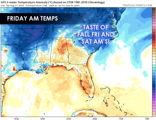
It will be nice all week, if not stellar, but then on Saturday some could experience a washout. That’s typical these days right? But asRead More
Can we get fall to stick? Maybe so! After this week and weekend, it looks like no major heat is in store for the foreseeableRead More
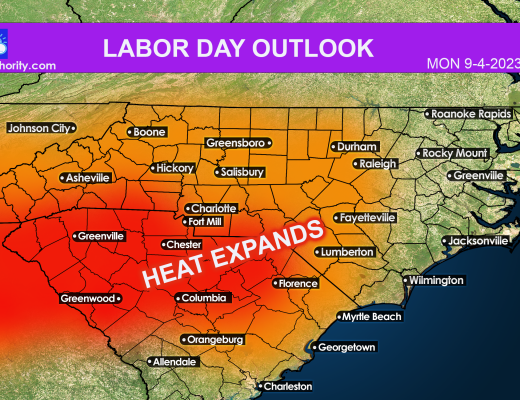
A large-scale area of high pressure is taking shape, and will start to move into our area Monday. This means that temperatures will start toRead More
Enjoy the fall-like temperatures while you can, because heading into the late holiday weekend (Sun-Mon) another heatwave will take shape! But until then we canRead More
