

We have been following the potential for a coastal low of either sub-tropical or tropical origin. The timing is on Monday, and honestly anywhere fromRead More
We have been following the potential for a coastal low of either sub-tropical or tropical origin. The timing is on Monday, and honestly anywhere fromRead More

It’s been dry, and as Hurricane Beryl makes landfall in Texas early this week, it will curve northeastward as it moves inland. As a result,Read More

Yes it’s June and it will naturally feel warm and humid, however it could be way worse. But what we are dodging into the middleRead More

There will be a much welcomed sight this week – below normal temperatures for this time of year. While it won’t feel cold outside, theRead More

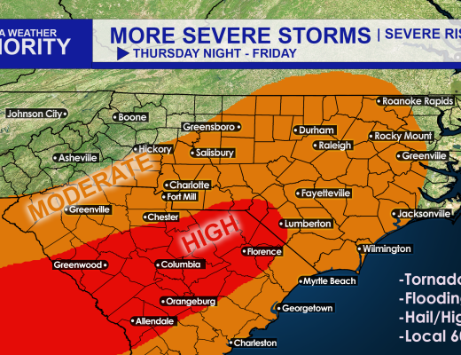
It’s shaping up to be an active pattern with severe storms over the next few days including today. High winds, hail, and even a briefRead More

We will dry out to start the week, however the pattern will remain unsettled with the chance of showers and storms each day this weekRead More
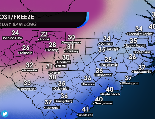
Cover those outdoor sensitive plants, as a widespread frost is likely across much of NC and SC. The more inland you go, the higher likelihoodRead More
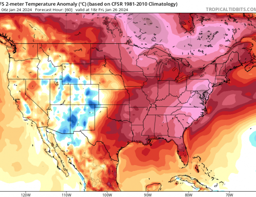
After an Arctic airmass over the past week or two, things will flip back over to the other extreme, way above normal temperatures. Temperatures onRead More
Charge those phones and prepare for more power outages! This is not welcome news due to the recent “land hurricane,” but more unstable weather willRead More
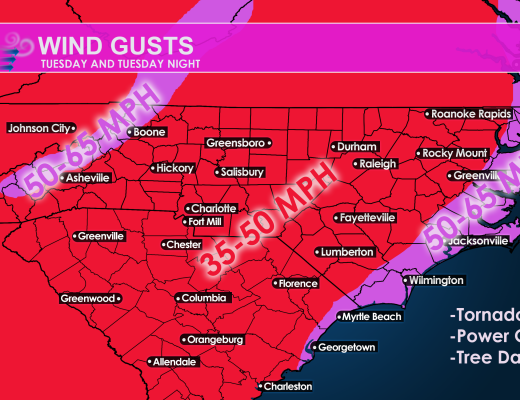
There is a high likelihood of severe weather Tuesday across the region. Power outages are possible so be sure to charge those electronic devices. However,Read More

You must be logged in to post a comment.