
Skip to content
Latest
  • Latest 2026-27 Winter Outlook for the Carolinas
  • Winter 2026-27 May Not Be What We Expect in the Carolinas
  • A Drop Down to Normal Just In Time for Fall?
  • Hot September Incoming
  • Single Digits Likely Tonight in the Carolinas
Carolina Weather Authority

Carolina Weather Authority

  • Home
  • Map Wall
  • Home
  • Michael Griffith
  • Page 141

Author: Michael Griffith

I have had a passion for the weather since a very young age and am a degreed meteorologist. I have a Bachelor of Science from Penn State University and a Master's from Plymouth State University. If you ever see me out and about in the Charlotte, NC or Fort Mill, SC area, be sure to say hi!

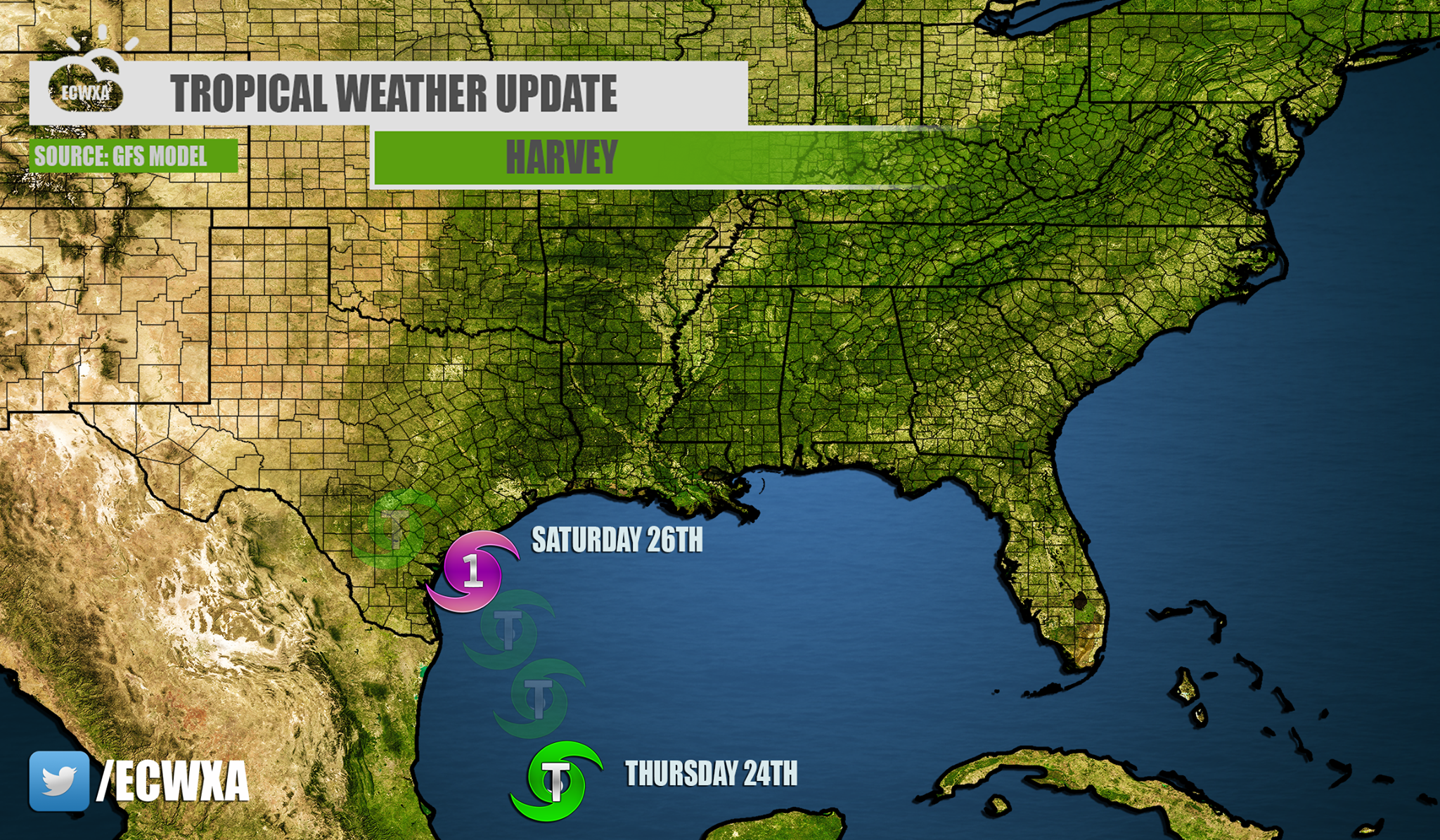
Latest Landfall Track for Harvey Is From Texas to Louisiana

August 23, 2017 By Michael Griffith

HARVEY TO THREATEN TEXAS COAST, LOUISIANA The GFS model has been fairly consistent with a landfall somewhere along the Texas Coast. The GEFS ensembles haveRead More

Share to inform your family and friends!

  • Tweet
  • Email a link to a friend (Opens in new window) Email

Like this:

Like Loading…

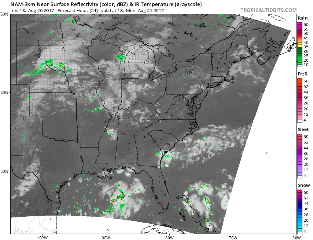
Latest Video on The Tropics Plus Pattern Change Coming

August 22, 2017 By Michael Griffith

HARVEY EXPECTED TO IMPACT TEXAS COAST, COLD FRONT PUSHING THROUGH EASTERN THIRD OF US Harvey is making headlines in the Gulf, as well as InvestRead More
Share to inform your family and friends!

  • Tweet
  • Email a link to a friend (Opens in new window) Email

Like this:

Like Loading…

Latest Eclipse 2017 Viewing Conditions Forecast

August 20, 2017 By Michael Griffith

MOST OF THE PATH IN THE SOUTHEAST LOOKS TO BE CLOUD FREE, CHARLESTON IS IFFY Much of the Southeast looks like it will be inRead More
Share to inform your family and friends!

  • Tweet
  • Email a link to a friend (Opens in new window) Email

Like this:

Like Loading…

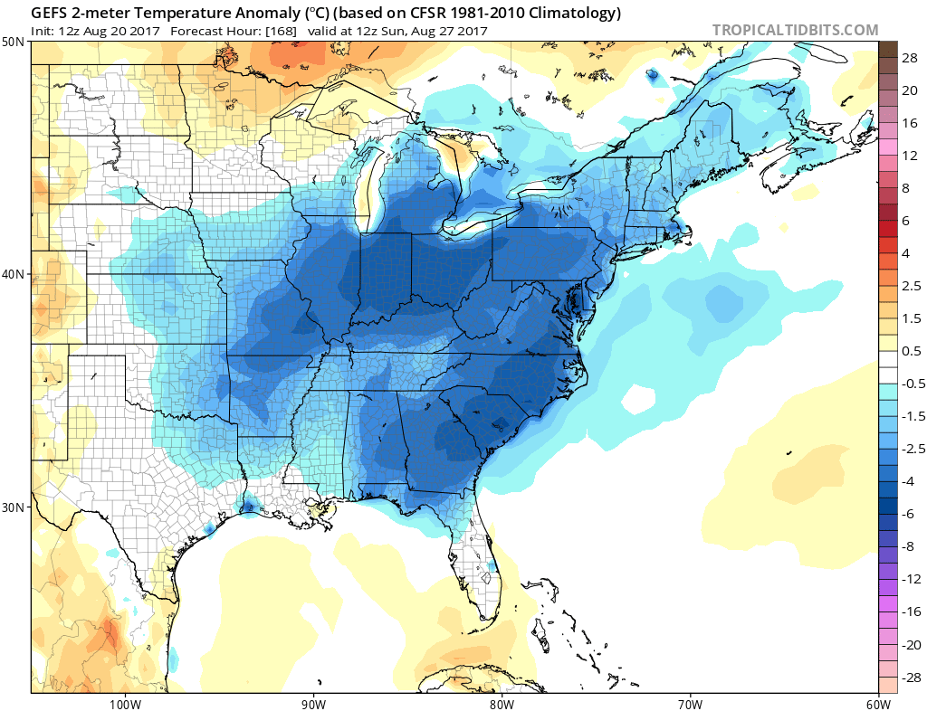
Cool Down Coming For Many in the East

August 20, 2017 By Michael Griffith

COOL DOWN COMING FOR MANY, MOST LIKELY TO BE FELT IN THE SOUTHEAST The GEFS ensembles are locking on to the idea of below normalRead More
Share to inform your family and friends!

  • Tweet
  • Email a link to a friend (Opens in new window) Email

Like this:

Like Loading…

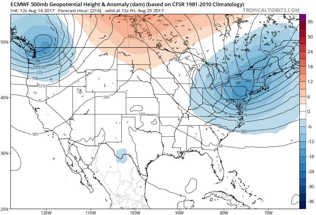
After Some Heat, Euro Goes Back To Cool

August 16, 2017 By Michael Griffith

BRIEF WARMTH FOLLOWED BY BURSTS OF COOLER AIR Well there has been a lot of storminess, especially here in the Southeast. We are looking atRead More
Share to inform your family and friends!

  • Tweet
  • Email a link to a friend (Opens in new window) Email

Like this:

Like Loading…

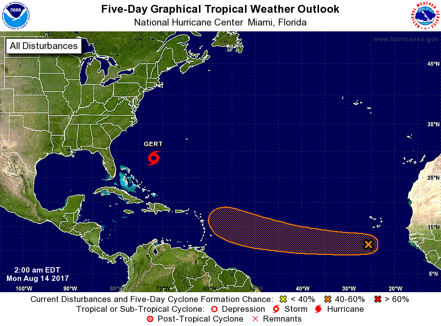
Tropical Wave With Potential Just Left Coast of Africa

August 13, 2017 By Michael Griffith

TROPICS REMAIN ACTIVE A tropical wave just left the West Coast of Africa, and the NHC as of now gives it a now 40-60% chanceRead More
Share to inform your family and friends!

  • Tweet
  • Email a link to a friend (Opens in new window) Email

Like this:

Like Loading…

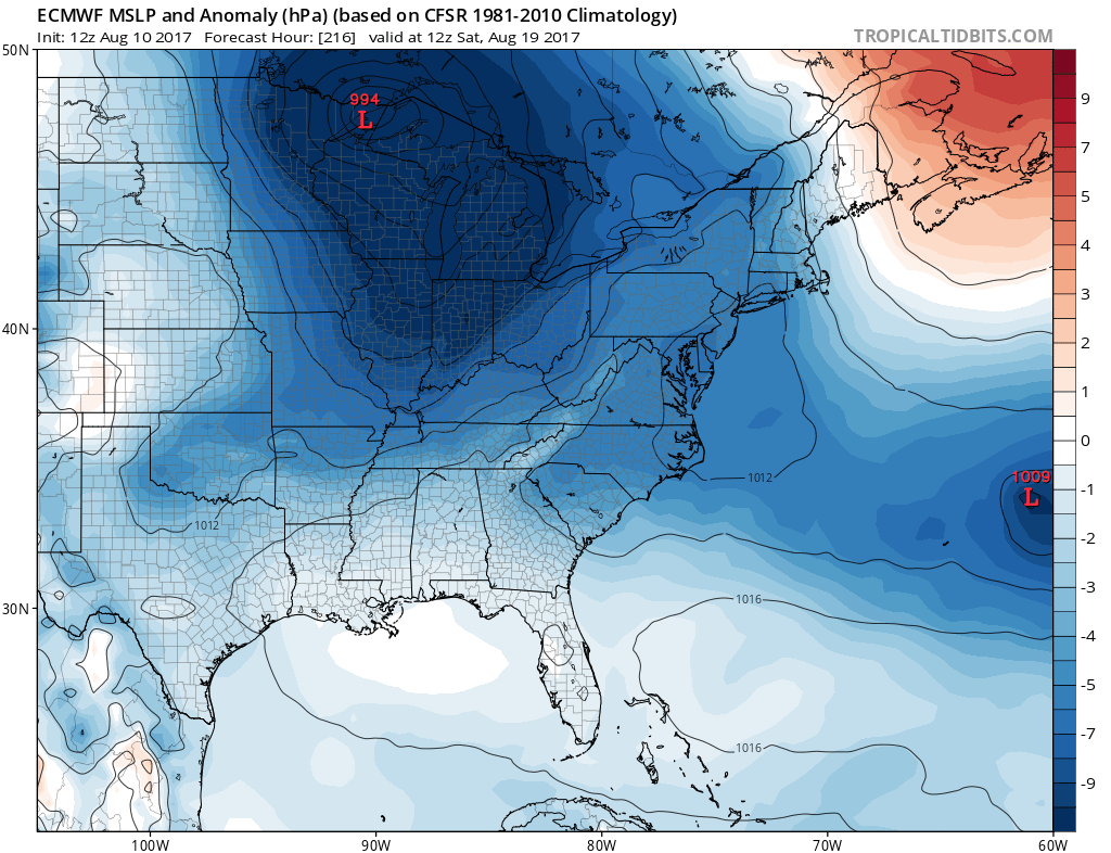
Large Area of Low Pressure Set to Move through the Great Lakes

August 10, 2017 By Michael Griffith

Sub-1000mb low is showing to move across the upper Great Lakes next weekend. This would mean a good shot for rain, and below normal temperatures.Read More
Share to inform your family and friends!

  • Tweet
  • Email a link to a friend (Opens in new window) Email

Like this:

Like Loading…

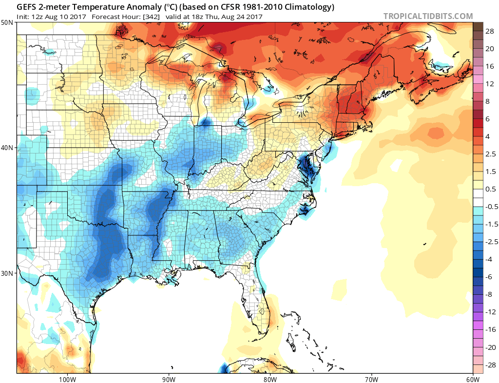
GEFS Ensembles Continue to Show Below Average into Late August

August 10, 2017 By Michael Griffith

THE TREND IS YOUR FRIEND, WHEN MODEL AGREEMENT OCCURS The GEFS ensembles continue to agree on a cooler Southeast US through a majority of thisRead More
Share to inform your family and friends!

  • Tweet
  • Email a link to a friend (Opens in new window) Email

Like this:

Like Loading…

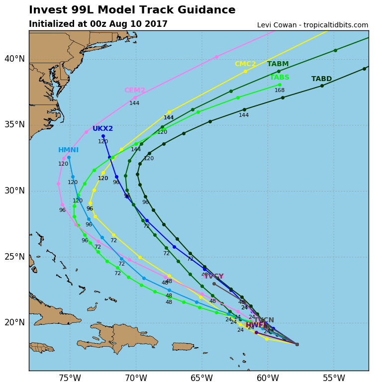
Tropical Cyclone Analogs Agree Invest 99L Turns Right

August 9, 2017 By Michael Griffith

ANALOGS FROM PAST CONDITIONS REVEAL INVEST 99L SHOULD POSE NO THREAT TO LAND Many storms have had similar upper-air patterns for this time of year,Read More

Share to inform your family and friends!

  • Tweet
  • Email a link to a friend (Opens in new window) Email

Like this:

Like Loading…

Persistent Trough in the East Will Mean Cooler

August 9, 2017 By Michael Griffith

TROUGHING IN THE EAST WILL CAUSE BELOW NORMAL TEMPERATURES THROUGH MID-AUGUST Looking ahead into the next week, much of the East will remain below normalRead More

Share to inform your family and friends!

  • Tweet
  • Email a link to a friend (Opens in new window) Email

Like this:

Like Loading…

Posts navigation

Older posts
Newer posts

Like us on Facebook!

Like us on Facebook!

Active Alerts

Current NWS Watches, Warnings, and Advisories

7-Day Tropical Outlook

Today’s Severe Threat

Follow Us

  • Facebook
  • X
  • Instagram
  • YouTube
© 2019 Best blog in 21st Century
Powered by WordPress - Lekh by ThemeCentury
Carolina Weather Authority
Loading Comments...

You must be logged in to post a comment.

%d