
Skip to content
Latest
  • Latest 2026-27 Winter Outlook for the Carolinas
  • Winter 2026-27 May Not Be What We Expect in the Carolinas
  • A Drop Down to Normal Just In Time for Fall?
  • Hot September Incoming
  • Single Digits Likely Tonight in the Carolinas
Carolina Weather Authority

Carolina Weather Authority

  • Home
  • Map Wall
  • Home
  • Michael Griffith
  • Page 140

Author: Michael Griffith

I have had a passion for the weather since a very young age and am a degreed meteorologist. I have a Bachelor of Science from Penn State University and a Master's from Plymouth State University. If you ever see me out and about in the Charlotte, NC or Fort Mill, SC area, be sure to say hi!

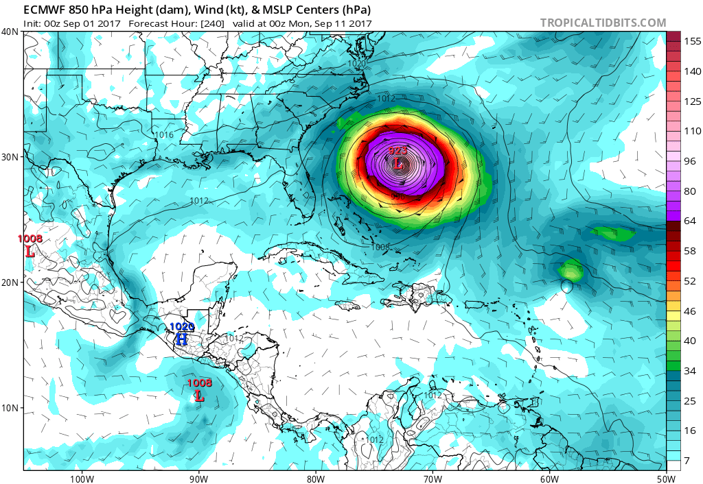
A Look at the Latest Models and What They Mean for Hurricane Irma

September 2, 2017 By Michael Griffith

Taking a look once again at the three major global forecast models, we are searching for some kind of trend or agreement. Hurricane Irma isRead More

Share to inform your family and friends!

  • Tweet
  • Email a link to a friend (Opens in new window) Email

Like this:

Like Loading…

Latest Comparison of the Three Major Forecast Models

September 1, 2017 By Michael Griffith

As of now, the GFS has Irma closely brushing the East Coast somewhere, namely the Outer Banks. This would only be an issue with wavesRead More

Share to inform your family and friends!

  • Tweet
  • Email a link to a friend (Opens in new window) Email

Like this:

Like Loading…

Remnants of Hurricane Harvey

September 1, 2017 By Michael Griffith

Hurricane Harvey devestated most of Eastern Texas over the last week. Now the remnants of it will be effecting our weather for the next coupleRead More
Like this:

Like Loading…

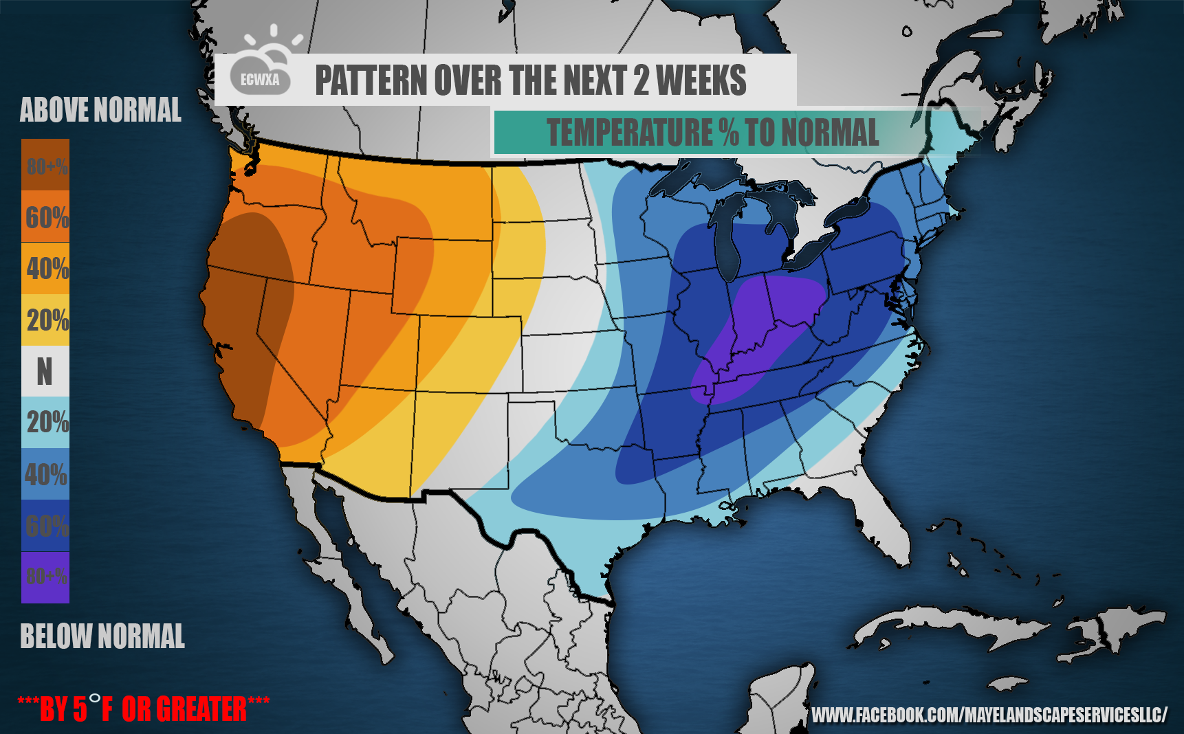
First Half of September to be Below Normal

August 31, 2017 By Michael Griffith

We are looking at below normal temperatures to start of September here in the East. At first, it will mainly be due to rain, howeverRead More
Share to inform your family and friends!

  • Tweet
  • Email a link to a friend (Opens in new window) Email

Like this:

Like Loading…

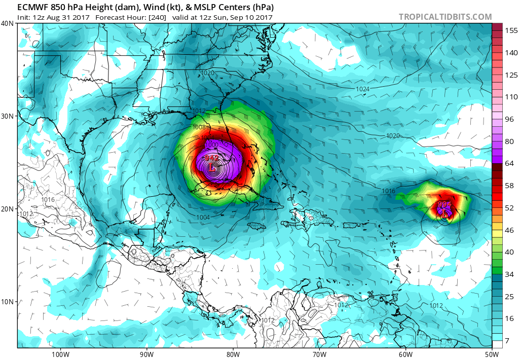
Comparison of Three Major Forecast Models, And What They Could Mean

August 31, 2017 By Michael Griffith

When looking at hurricanes in the medium-to-long range, we must see if there are any similarities between the models, as in agreement. If there isRead More
Share to inform your family and friends!

  • Tweet
  • Email a link to a friend (Opens in new window) Email

Like this:

Like Loading…

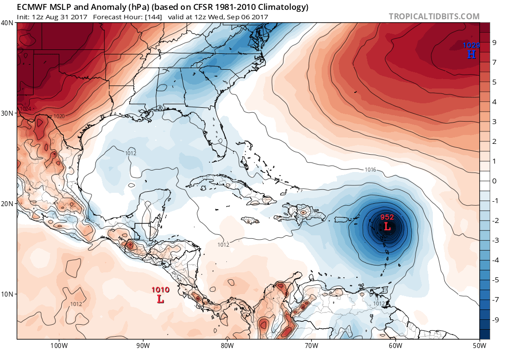
Hurricane Irma

August 31, 2017 By Michael Griffith

Irma went from a 70mph Tropical Storm to a Category 2 Hurricane in only 6 hours. Conditions are favorable for MUCH more development over theRead More

Share to inform your family and friends!

  • Tweet
  • Email a link to a friend (Opens in new window) Email

Like this:

Like Loading…

Irma Likely to Become Hurricane Thursday, Major Hurricane This Weekend

August 30, 2017 By Michael Griffith

As if things couldn’t get any worse, Irma is looking very dangerous in the Atlantic. The storm is expected to become a hurricane by ThursdayRead More
Share to inform your family and friends!

  • Tweet
  • Email a link to a friend (Opens in new window) Email

Like this:

Like Loading…

Possible Tropical System Off Carolina Coast Next Week

August 25, 2017 By Michael Griffith

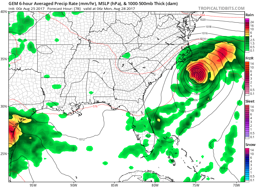
The Canadian model currently has the idea of a tropical depression or tropical storm off the coast of NC/SC by Monday. This system would mostRead More
Share to inform your family and friends!

  • Tweet
  • Email a link to a friend (Opens in new window) Email

Like this:

Like Loading…

Another Autumn-Like Cool Shot to Affect Mid-Atlantic, Northeast

August 25, 2017 By Michael Griffith

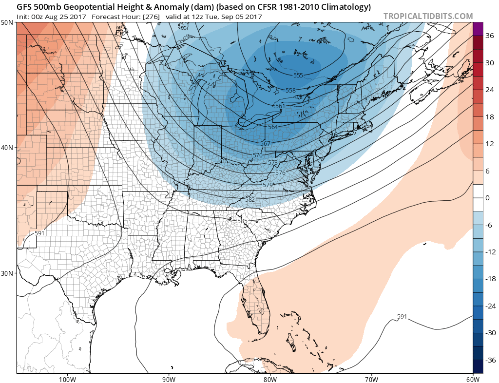
Looking into the first week of September, the GFS is showing another large-scale trough over the Eastern US and Mid-Atlantic around September 5th. This wouldRead More
Share to inform your family and friends!

  • Tweet
  • Email a link to a friend (Opens in new window) Email

Like this:

Like Loading…

Euro Shows New Tropical System to move off Africa Coast

August 23, 2017 By Michael Griffith

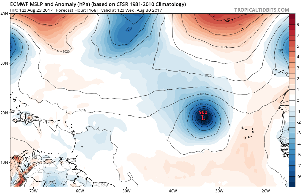
The European model spins something up just off the coast of Africa by next Wednesday. There is no worries this far out, since the strengthRead More

Share to inform your family and friends!

  • Tweet
  • Email a link to a friend (Opens in new window) Email

Like this:

Like Loading…

Posts navigation

Older posts
Newer posts

Like us on Facebook!

Like us on Facebook!

Active Alerts

Current NWS Watches, Warnings, and Advisories

7-Day Tropical Outlook

Today’s Severe Threat

Follow Us

  • Facebook
  • X
  • Instagram
  • YouTube
© 2019 Best blog in 21st Century
Powered by WordPress - Lekh by ThemeCentury
Carolina Weather Authority
Loading Comments...

You must be logged in to post a comment.

%d