
BRIEF WARMTH FOLLOWED BY BURSTS OF COOLER AIR Well there has been a lot of storminess, especially here in the Southeast. We are looking atRead More
BRIEF WARMTH FOLLOWED BY BURSTS OF COOLER AIR Well there has been a lot of storminess, especially here in the Southeast. We are looking atRead More
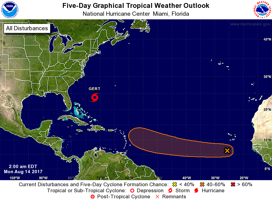
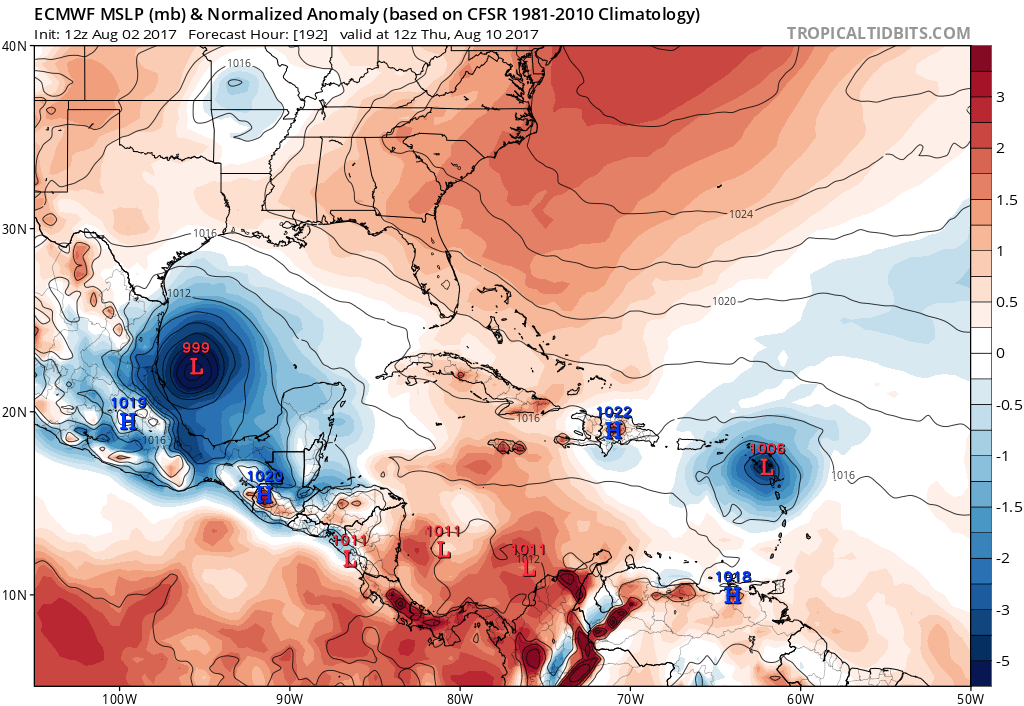
TROPICS REMAIN ACTIVE A tropical wave just left the West Coast of Africa, and the NHC as of now gives it a now 40-60% chanceRead More
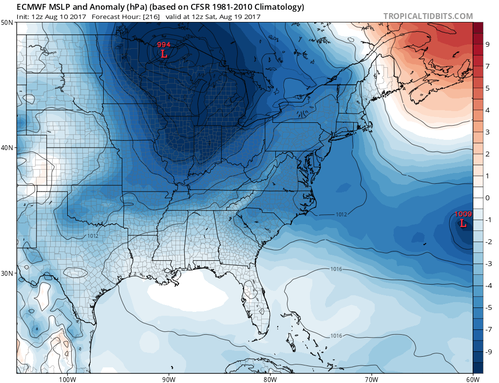
Sub-1000mb low is showing to move across the upper Great Lakes next weekend. This would mean a good shot for rain, and below normal temperatures.Read More
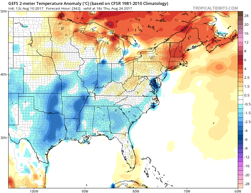
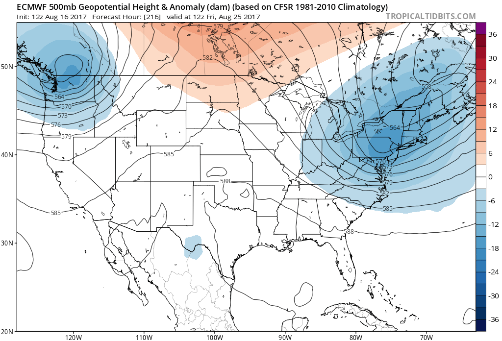
THE TREND IS YOUR FRIEND, WHEN MODEL AGREEMENT OCCURS The GEFS ensembles continue to agree on a cooler Southeast US through a majority of thisRead More
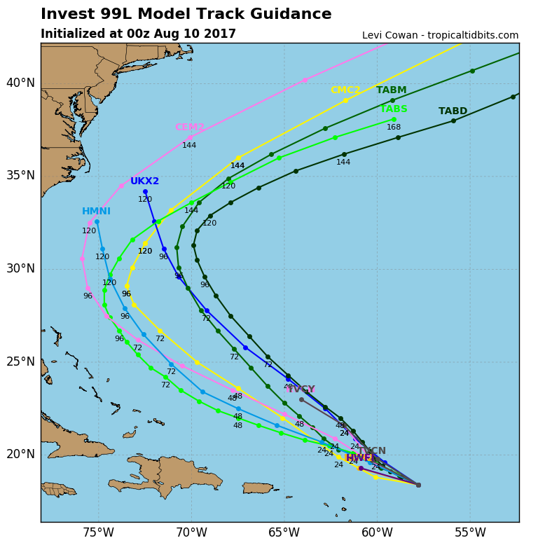
ANALOGS FROM PAST CONDITIONS REVEAL INVEST 99L SHOULD POSE NO THREAT TO LAND Many storms have had similar upper-air patterns for this time of year,Read More

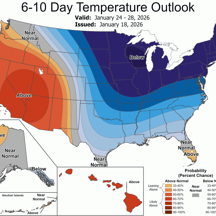
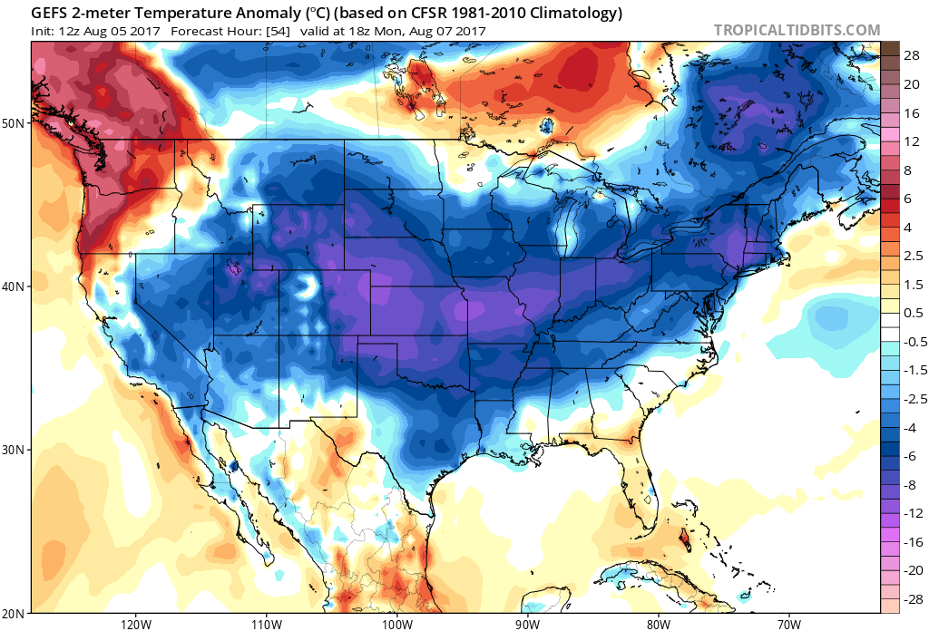
TROUGHING IN THE EAST WILL CAUSE BELOW NORMAL TEMPERATURES THROUGH MID-AUGUST Looking ahead into the next week, much of the East will remain below normalRead More
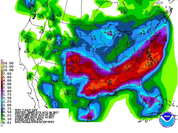
FLOODING RAINS LIKELY OVER THE SOUTH, EASTERN NORTH CAROLINA It’s looking like a wet week ahead. Off and on showers and thunderstorms, with some severe,Read More
GEFS INDICATES NO HEATWAVES IN THE NEAR FUTURE Good news for all the heat haters, we will not see any death ridges of high pressureRead More
EURO SHOWS TWO TROPICAL WAVES OVER THE NEXT WEEK Latest run of the Euro shows two distinct tropical waves. One that forms near or overRead More
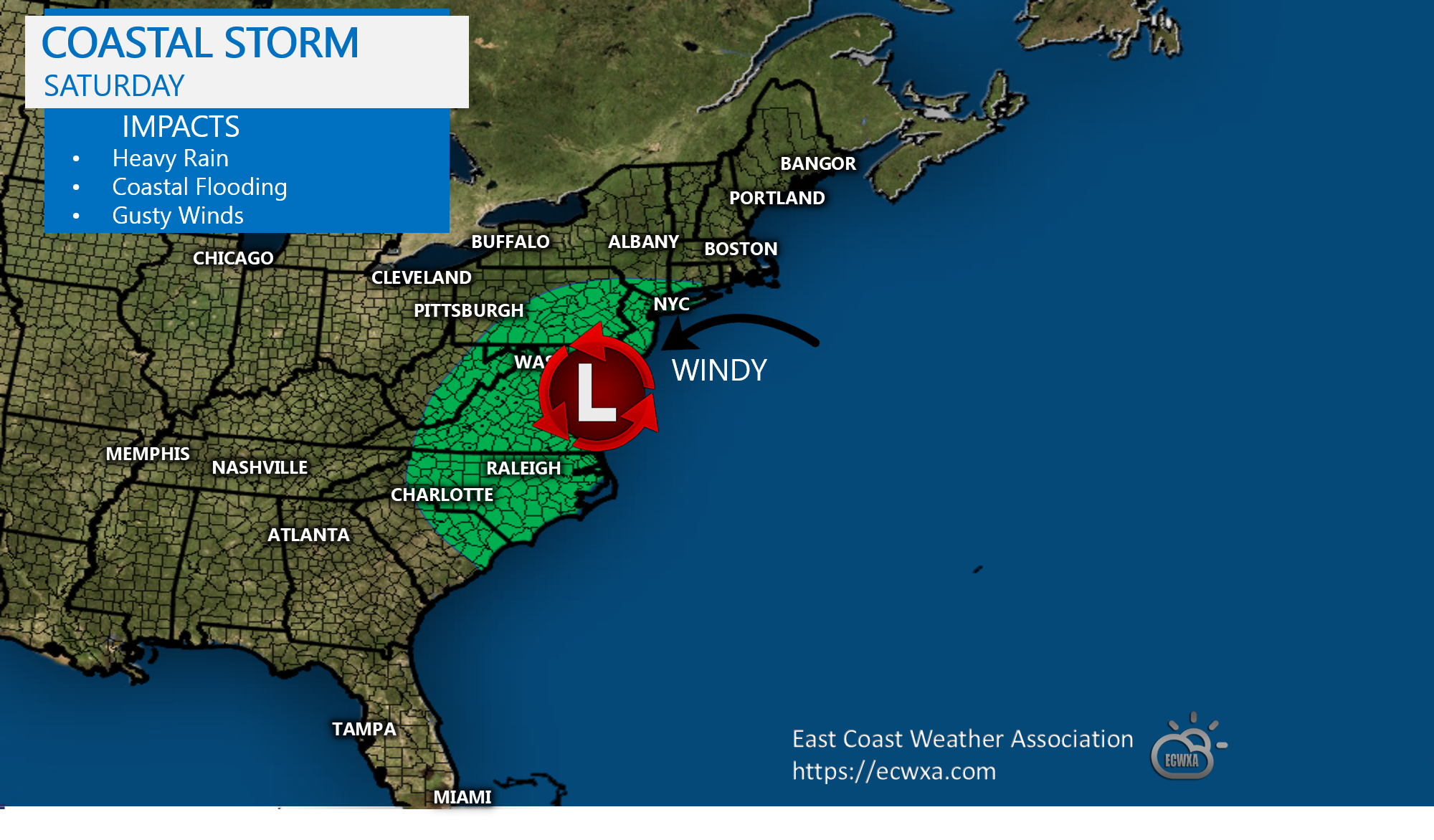
HEAVY RAINS, GUSTY WINDS, AND COASTAL FLOODING ON THE MENU THIS WEEKEND As two pieces of upper-level energy merge and combine Friday, a major rareRead More

You must be logged in to post a comment.