
When looking at hurricanes in the medium-to-long range, we must see if there are any similarities between the models, as in agreement. If there isRead More
When looking at hurricanes in the medium-to-long range, we must see if there are any similarities between the models, as in agreement. If there isRead More
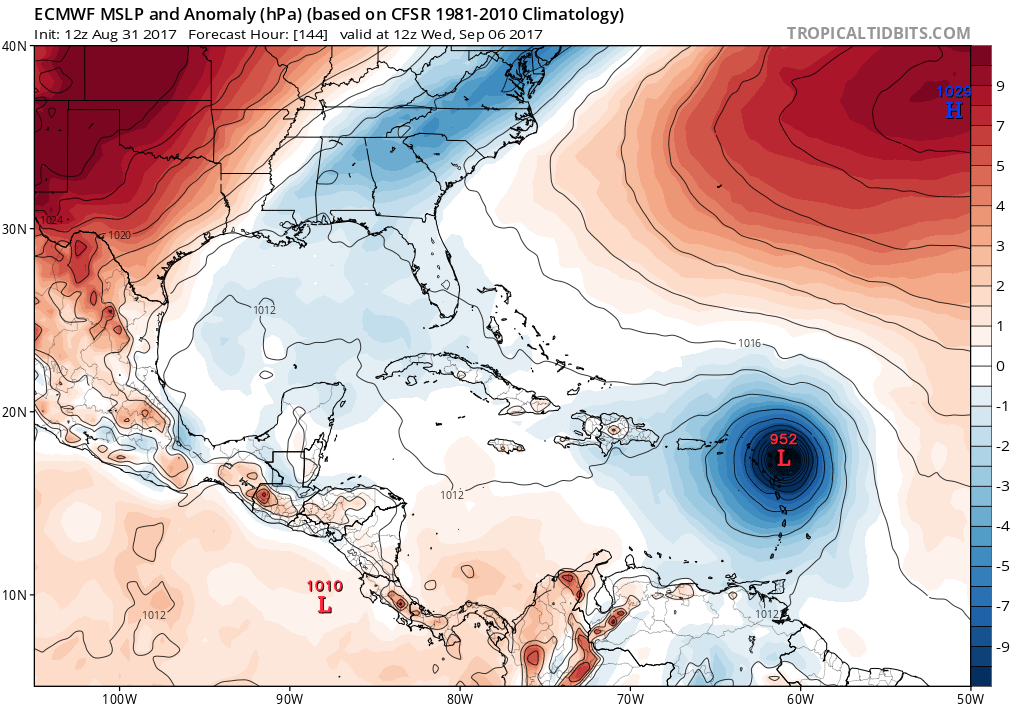
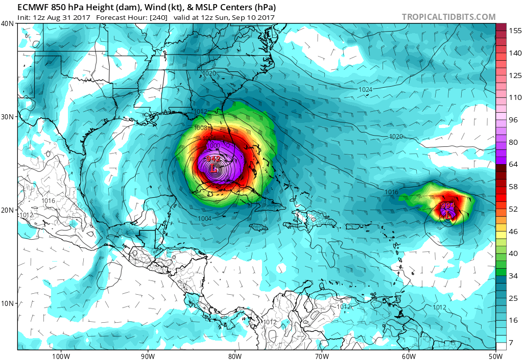
Irma went from a 70mph Tropical Storm to a Category 2 Hurricane in only 6 hours. Conditions are favorable for MUCH more development over theRead More

As if things couldn’t get any worse, Irma is looking very dangerous in the Atlantic. The storm is expected to become a hurricane by ThursdayRead More
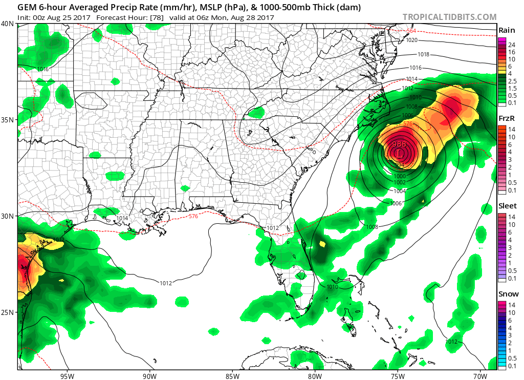
The Canadian model currently has the idea of a tropical depression or tropical storm off the coast of NC/SC by Monday. This system would mostRead More
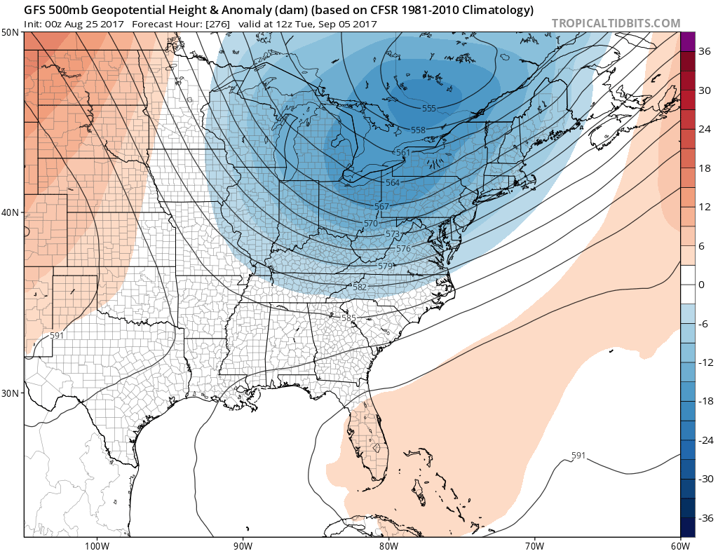
Looking into the first week of September, the GFS is showing another large-scale trough over the Eastern US and Mid-Atlantic around September 5th. This wouldRead More
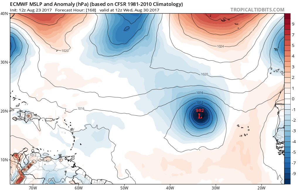
The European model spins something up just off the coast of Africa by next Wednesday. There is no worries this far out, since the strengthRead More
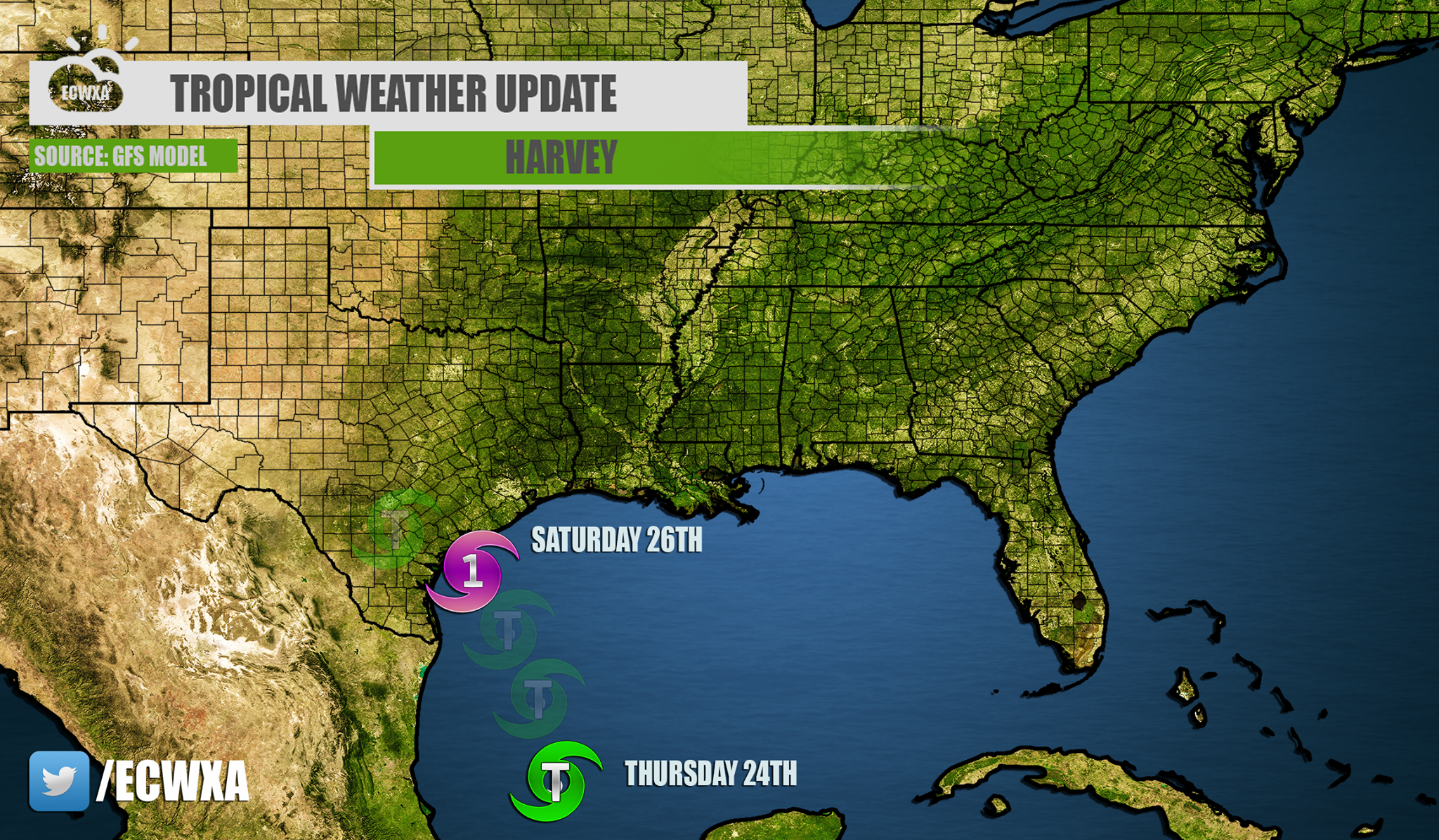
HARVEY TO THREATEN TEXAS COAST, LOUISIANA The GFS model has been fairly consistent with a landfall somewhere along the Texas Coast. The GEFS ensembles haveRead More
HARVEY EXPECTED TO IMPACT TEXAS COAST, COLD FRONT PUSHING THROUGH EASTERN THIRD OF US Harvey is making headlines in the Gulf, as well as InvestRead More
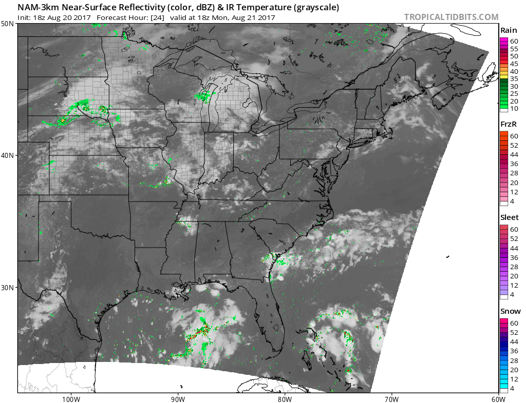
MOST OF THE PATH IN THE SOUTHEAST LOOKS TO BE CLOUD FREE, CHARLESTON IS IFFY Much of the Southeast looks like it will be inRead More
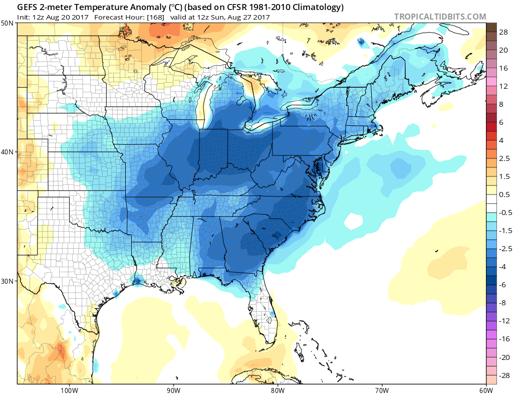
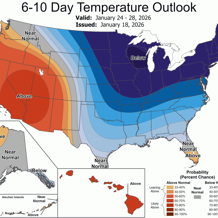
COOL DOWN COMING FOR MANY, MOST LIKELY TO BE FELT IN THE SOUTHEAST The GEFS ensembles are locking on to the idea of below normalRead More

You must be logged in to post a comment.