
There has been consistency in the model runs for the end of this month, around the 28th into the 30th. This trough of low pressureRead More
There has been consistency in the model runs for the end of this month, around the 28th into the 30th. This trough of low pressureRead More
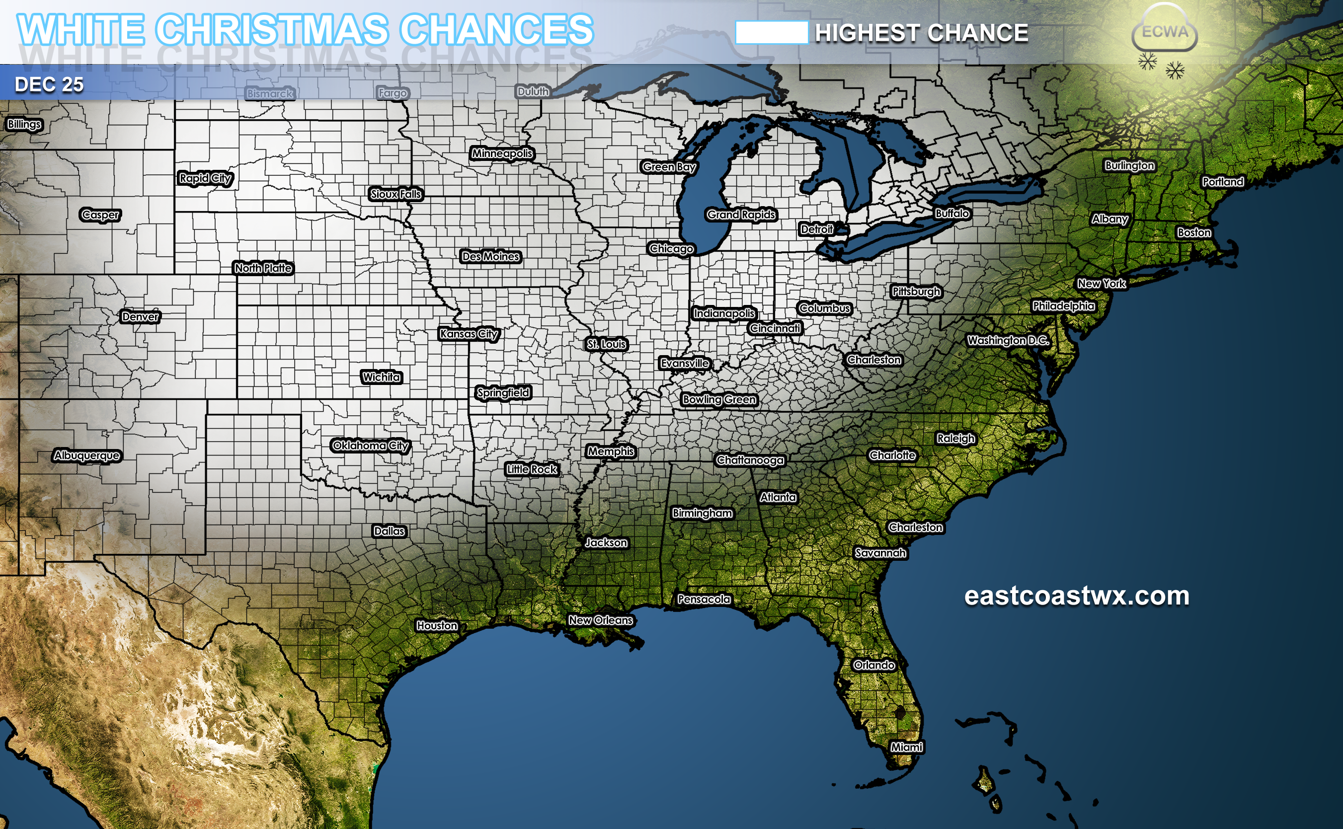
CHRISTMAS 2017 A very cold air mass is set to move in around Christmas Eve, and will become an active cold air mass on ChristmasRead More
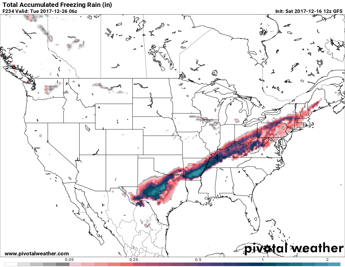
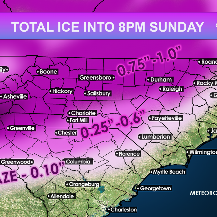
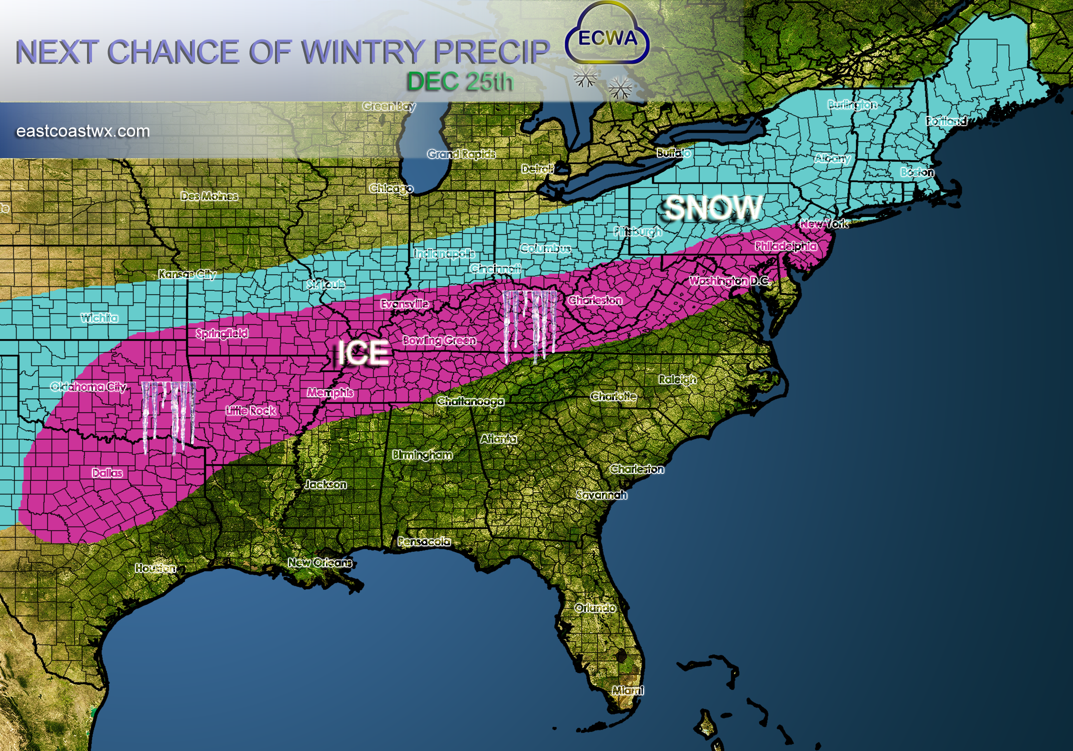
As colder air spills across the Plains on the 24th and 25th, there is a trend to watch, and that trend is ice. Freezing rainRead More
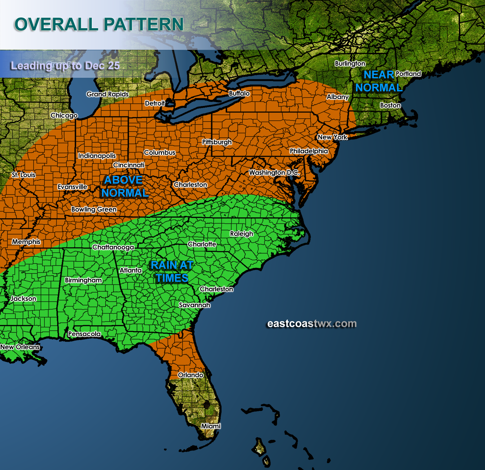
From the 15th to Christmas Day (Dec 25th), above normal temperatures will take over the eastern half of the US. Things will be tranquil intoRead More
While much of the East becomes warm, as a ridge of high pressure will build in, the Midwest will remain cold with disturbances moving inRead More
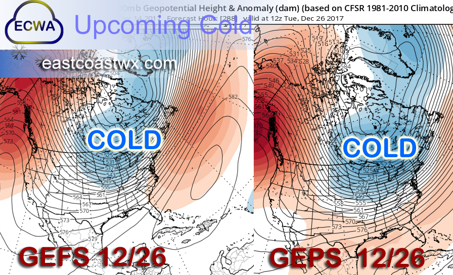
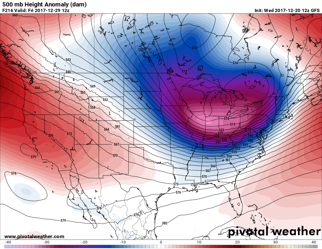
As many are confused as to what to expect for Christmas, weather-wise, there is some better agreement in the models after Christmas. Of course thisRead More
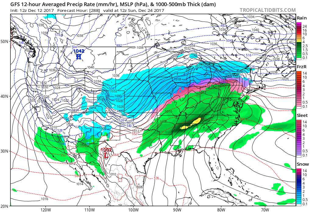
WINTER STORM POSSIBLE AROUND CHRISTMAS WITH SNOW SLEET AND FREEZING RAIN The GFS has a classic ice storm set upRead More
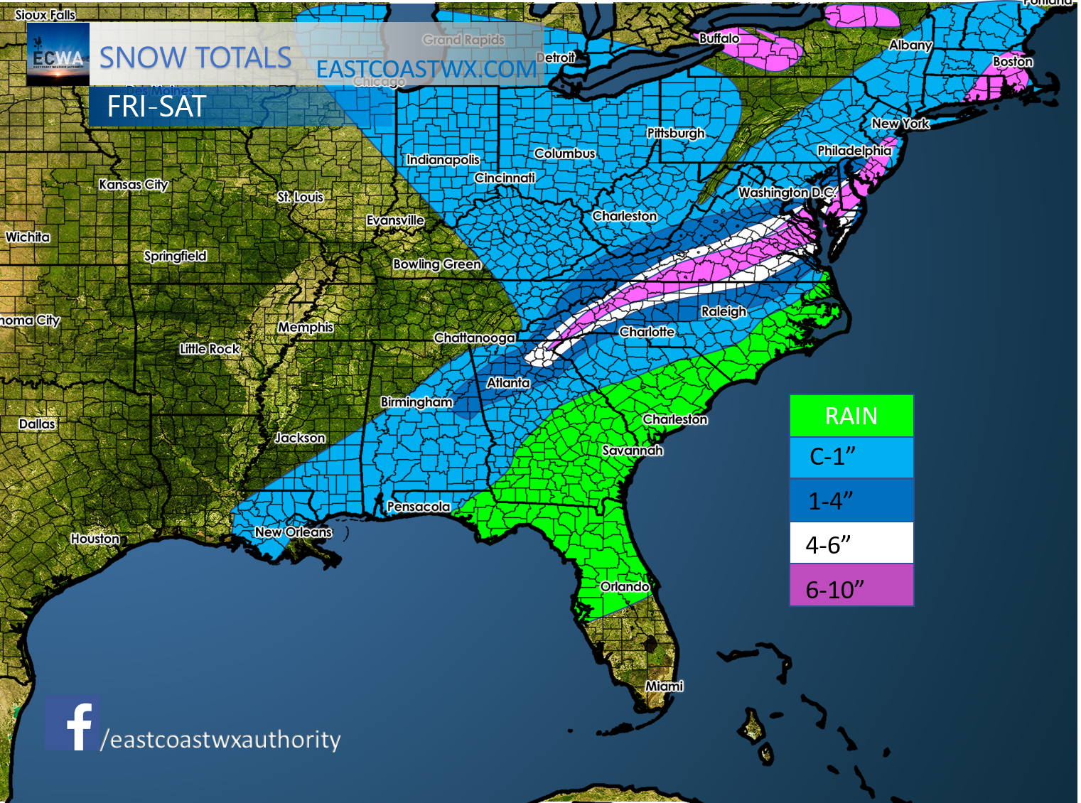
SOUTHERN SNOWSTORM DECEMBER 2017 Total accumulation buest guess estimate. I would say there could be spots in the white that get unloaded on, in someRead More
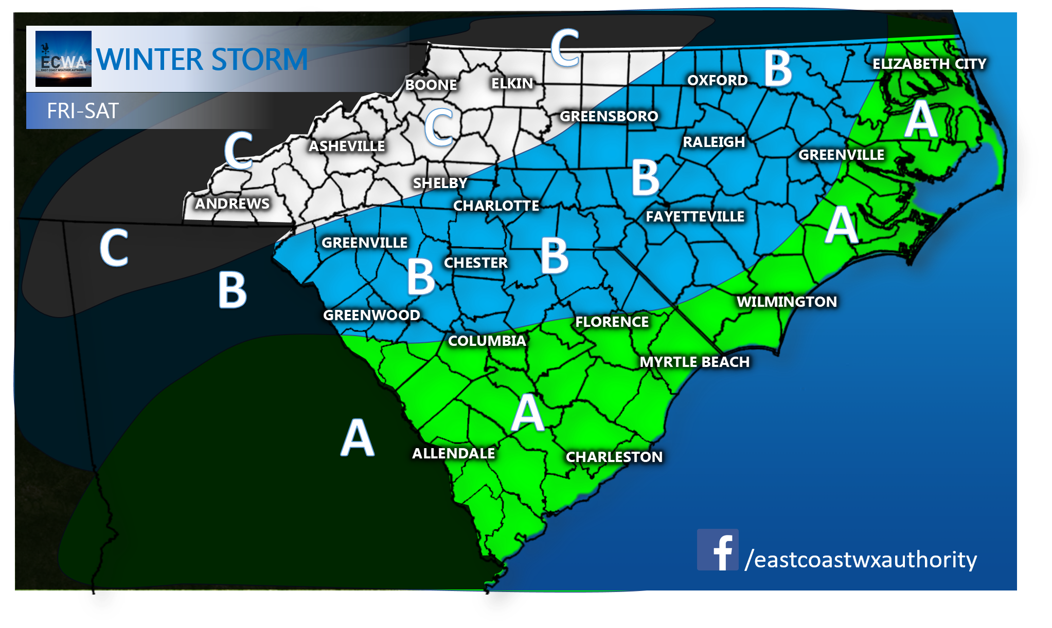
A winter storm is taking shape across the South, and will continue to do so throughout today and tonight into early Saturday morning. It isRead More
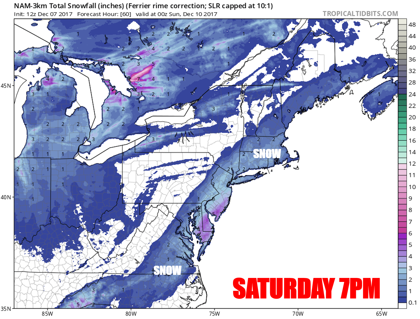
On Friday night, a wave of low pressure is forecast to move offshore and along the coast. This will throw back moisture over a coldRead More

You must be logged in to post a comment.