
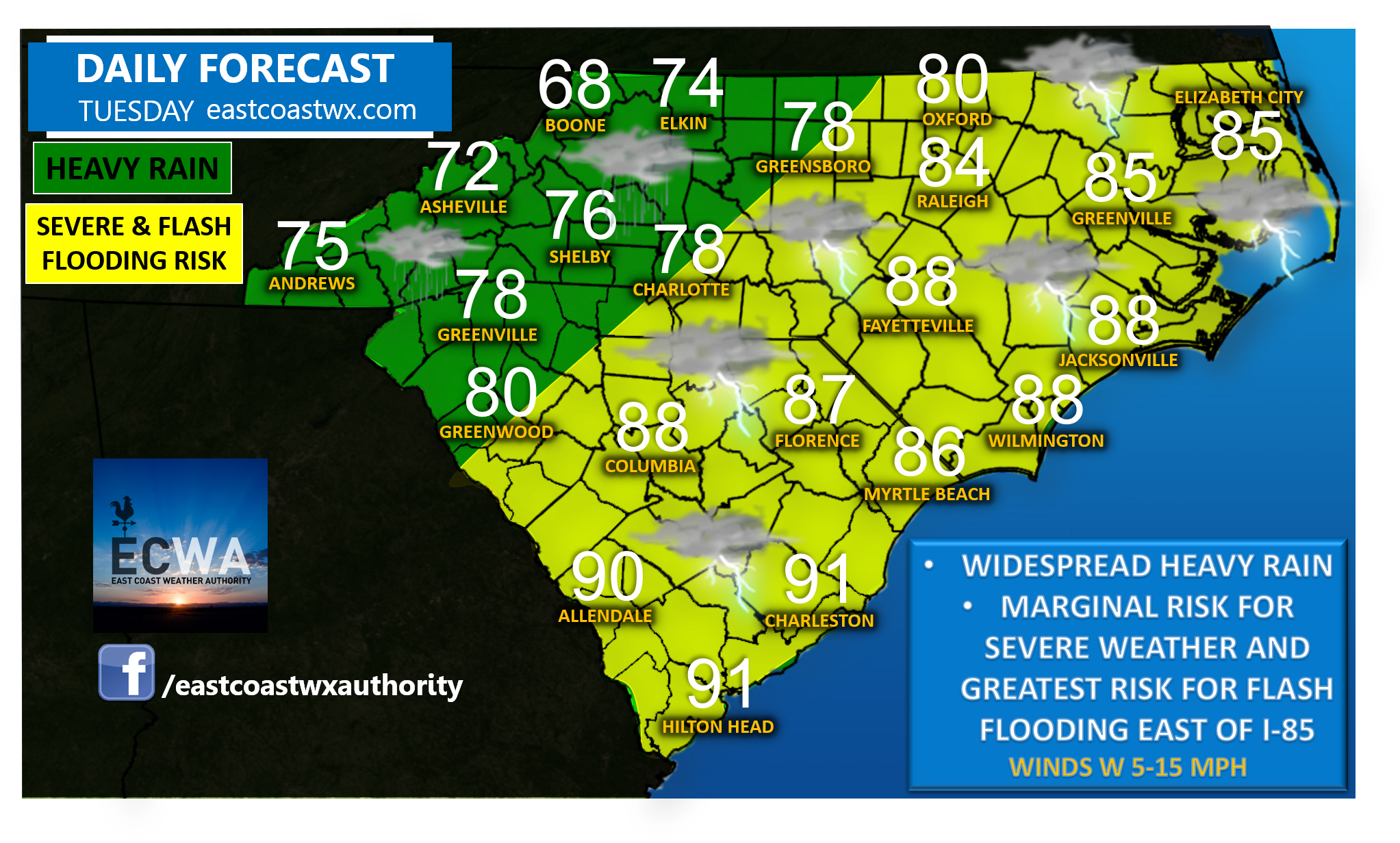
A cold front will bring about widespread showers and thunderstorms Tuesday, and provide at least a low risk for flash flooding everywhere. Rain will beRead More
A cold front will bring about widespread showers and thunderstorms Tuesday, and provide at least a low risk for flash flooding everywhere. Rain will beRead More

Low-level closed circulation has closed off today which has made Invest 94L become Tropical Depression 3. Maximum sustained winds are at 25 knots or aboutRead More
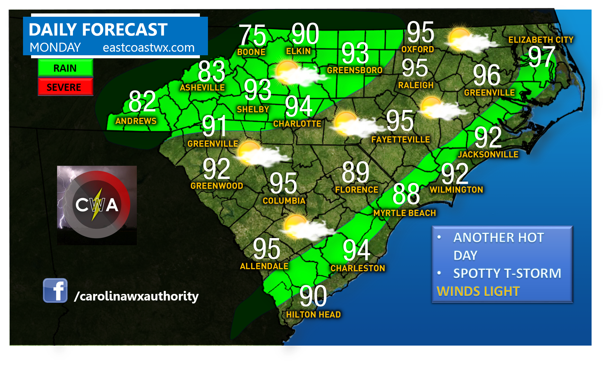
Monday will feature another hot day with widespread mid 90s for highs. Chances are higher for spotty showers and thunderstorms in western NC as wellRead More
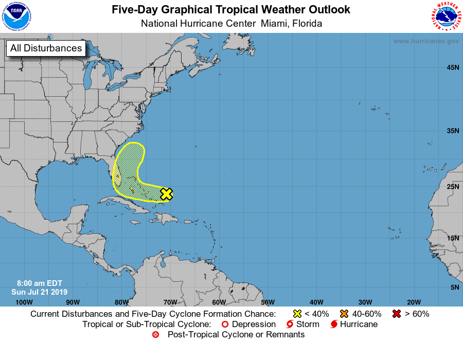
A disturbance over the Bahamas will slowly drift towards the Southeast Coast this week. At this time nothing major is expected other than heavy rains.Read More
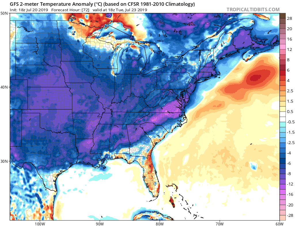
It has been hot, and not exactly in the most southern locations. It has been hotter in Virginia and the Carolinas than it has beenRead More
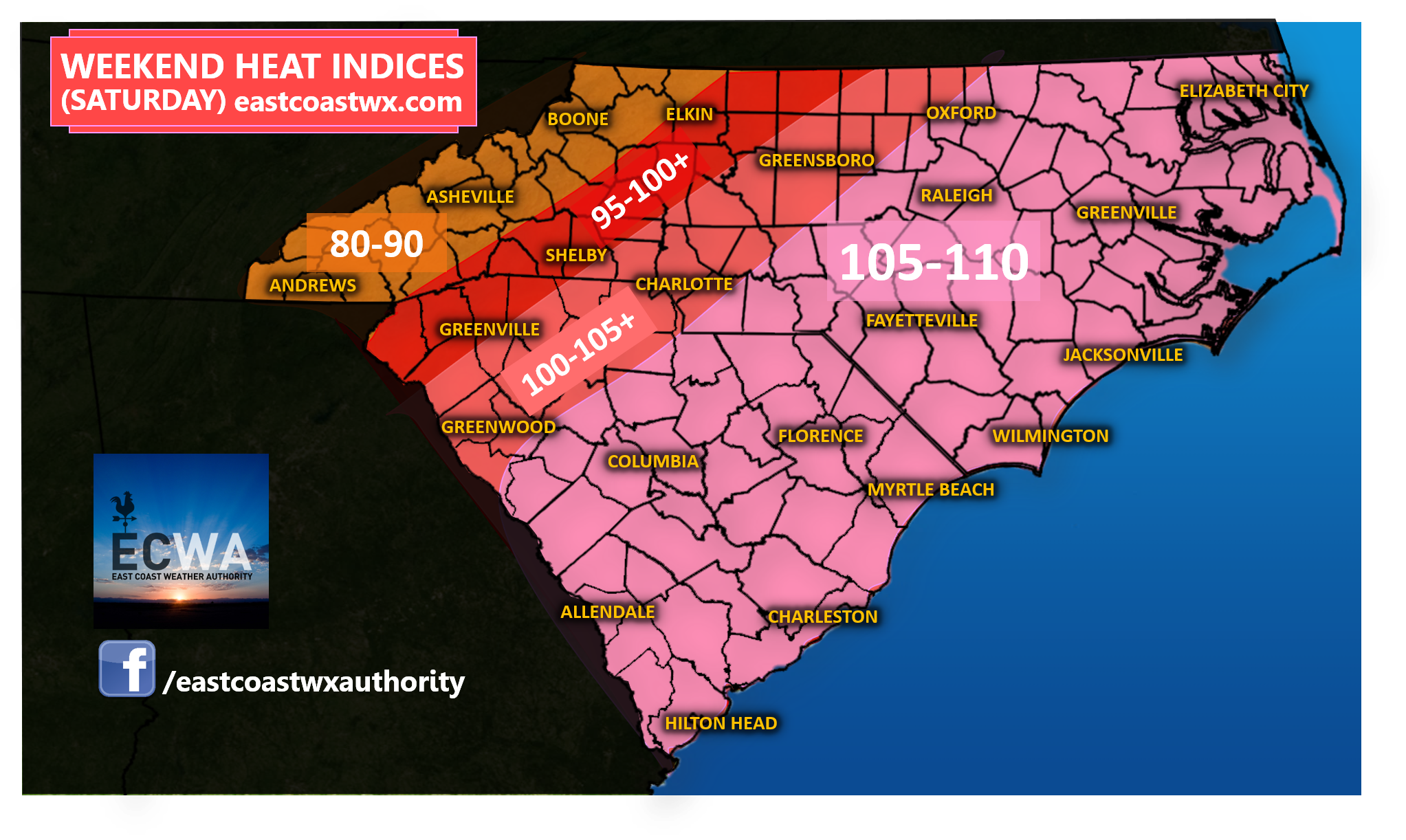
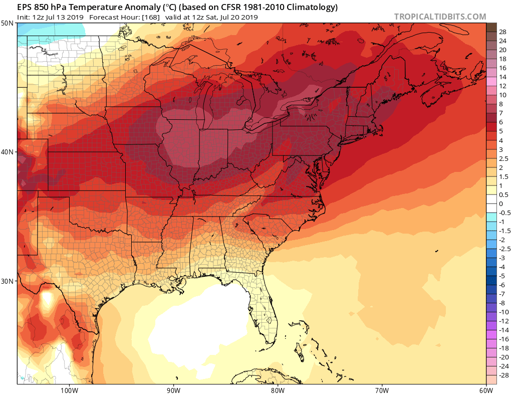
The heatwave already responsible for oppressive high temperatures and heat indices will crest at its peak this weekend, as dangerous heat and humidity collaborate toRead More
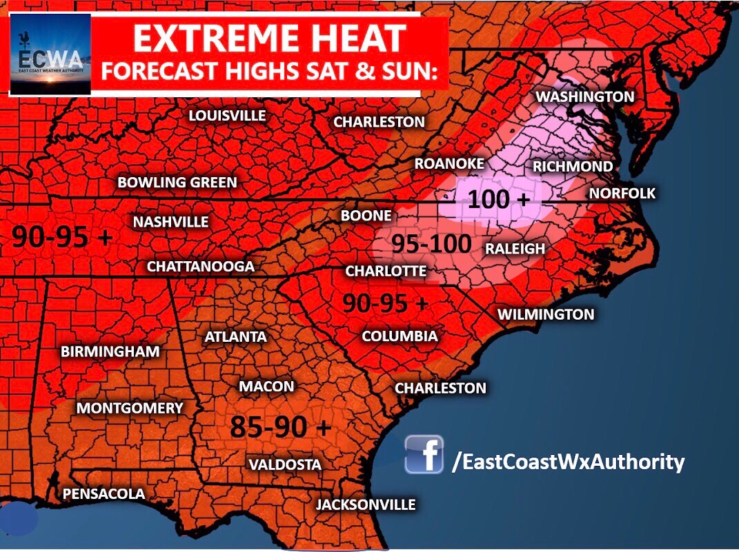
Intense and potentially record-breaking heat could be on the way for many areas this week and especially heading into this weekend. A ridge of highRead More
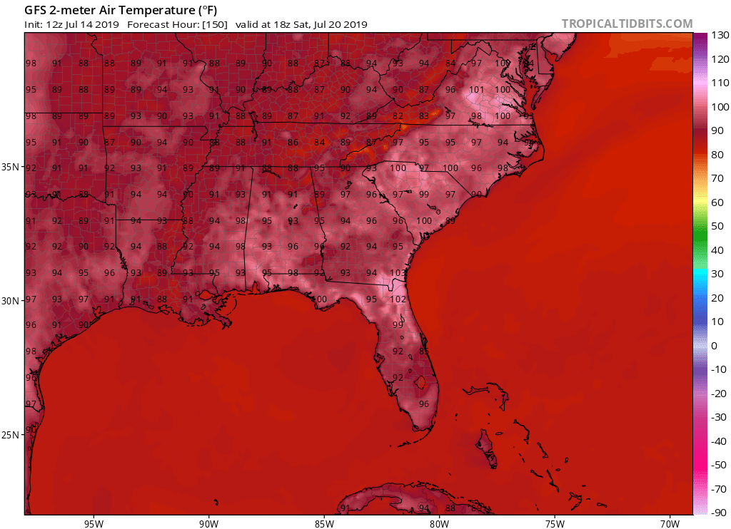
As the heat will build this week, it will come to a a climax this coming weekend. We will see temperatures slowly climb from theRead More
We have been kind of avoiding mid to upper 90s recently for the most part, however by next weekend many of us could be bakingRead More

We are continuing to watch the tropics behind Barry. All eyes should not get lost on him since there could be a tropical wave thatRead More

You must be logged in to post a comment.