
A ridge of high pressure centered over the Mid-South will continue to bring relentless heat to the Southeast and Mid-Atlantic this week with high temperaturesRead More
A ridge of high pressure centered over the Mid-South will continue to bring relentless heat to the Southeast and Mid-Atlantic this week with high temperaturesRead More
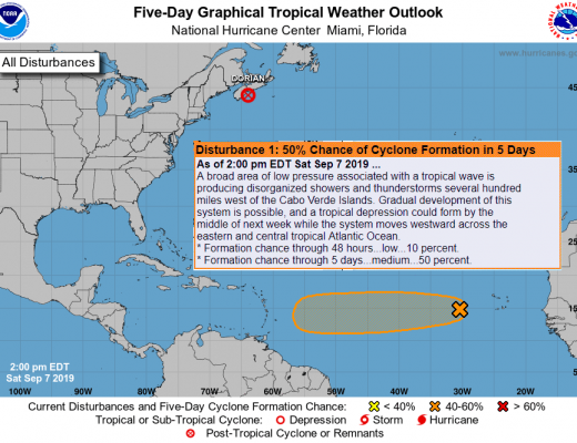
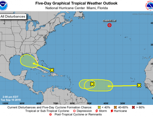
INVEST 94L FORMS IN THE ATLANTIC Invest 94L is our next disturbance in the Atlantic to watch. This system is currently located to the westRead More
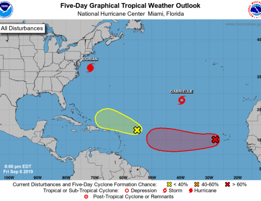
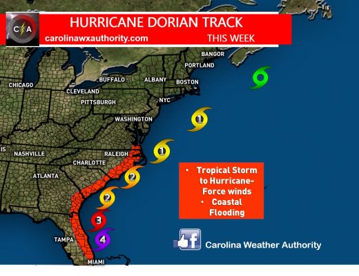
More Potential Areas to Watch Now that Dorian has exited the Carolina coast, we have some quieter times ahead in the tropics where we canRead More
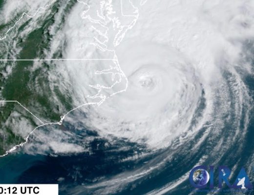
At 8:35 AM this morning, Dorian made landfall on the Outer Banks of North Carolina as a category 1 hurricane with sustained winds of 90Read More
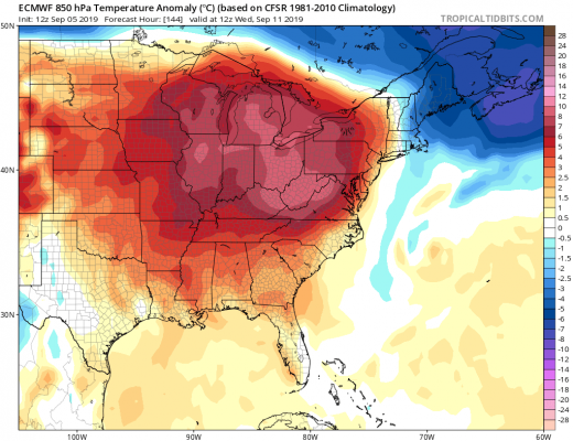
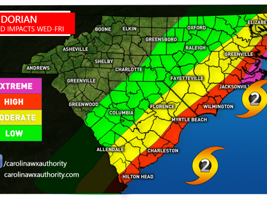
OUTLOOK THROUGH MID-SEPTEMBER It was though that cooler and less humid air may wrap in behind Dorian as he exits out to sea. This isRead More
Dorian continues to batter the Carolinas this evening as a category 2 hurricane with the eye wall just 40-50 miles off the Carolina coast betweenRead More
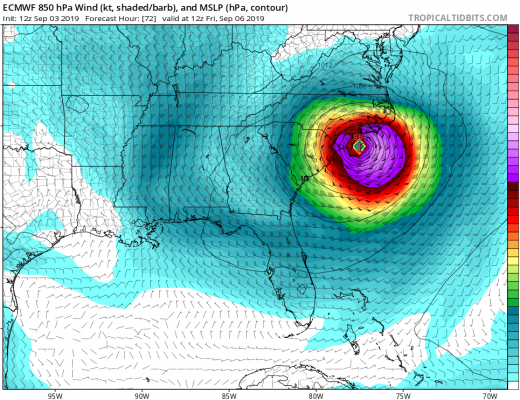
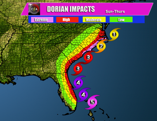
The Euro model may not have been getting the intensity of Dorian correct, however this model is noted for getting tracks correct. That being said,Read More
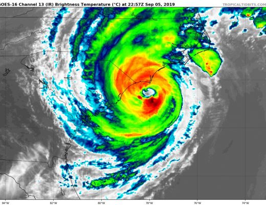
After pulverizing the Bahamas for over 24 hours with scarcely any movement, we’re finally beginning to see a shift in Dorian’s placement and intensity. LatestRead More
Hurricane Dorian is currently a Category 4 hurricane sitting just off the Florida Coast this Labor Day. Forward movement is expected to be small, asRead More
Hurricane Dorian is an extremely powerful and dangerous Category 5 hurricane, with sustained winds in excess of 180 mph. Gusts to 220 mph are possibleRead More

You must be logged in to post a comment.